
From Fuji-san to Hokkaido
____________________________
Frida On the Wrong Side of the Road
7 May 2013
Frida has arrived to Japan! After 30 days at sea in a small container, all the family was finally reunited! 

________________________
Fuji-san
10 May 2013
First we took Frida to Mount Fuji!
We slept at the parking lot of the 5th station. In the morning we woke up at 4 am and started our expedition to the top of Fuji-san, the highest and holiest mountain of Japan. Here is the sunrise from around 2300 m. 
The trail is “open” in July and August but it is absolutely possible to climb Mount Fuji outside the official opening season as well. Here is a view up the Yoshida trail. Everything is closed and even though it is May, there is still lots of snow. Be prepared for very icy conditions, strong winds and sudden change of weather!
We walked up the broad snowfield to the right of the Yoshida trail. The snow was firm and later icy. Crampons and ice axes were a must! Here Marco making a traverse – see how steep it was on the next picture.
It was absolutely very steep! It went on like this for 1000 metres till we reached the crater rim.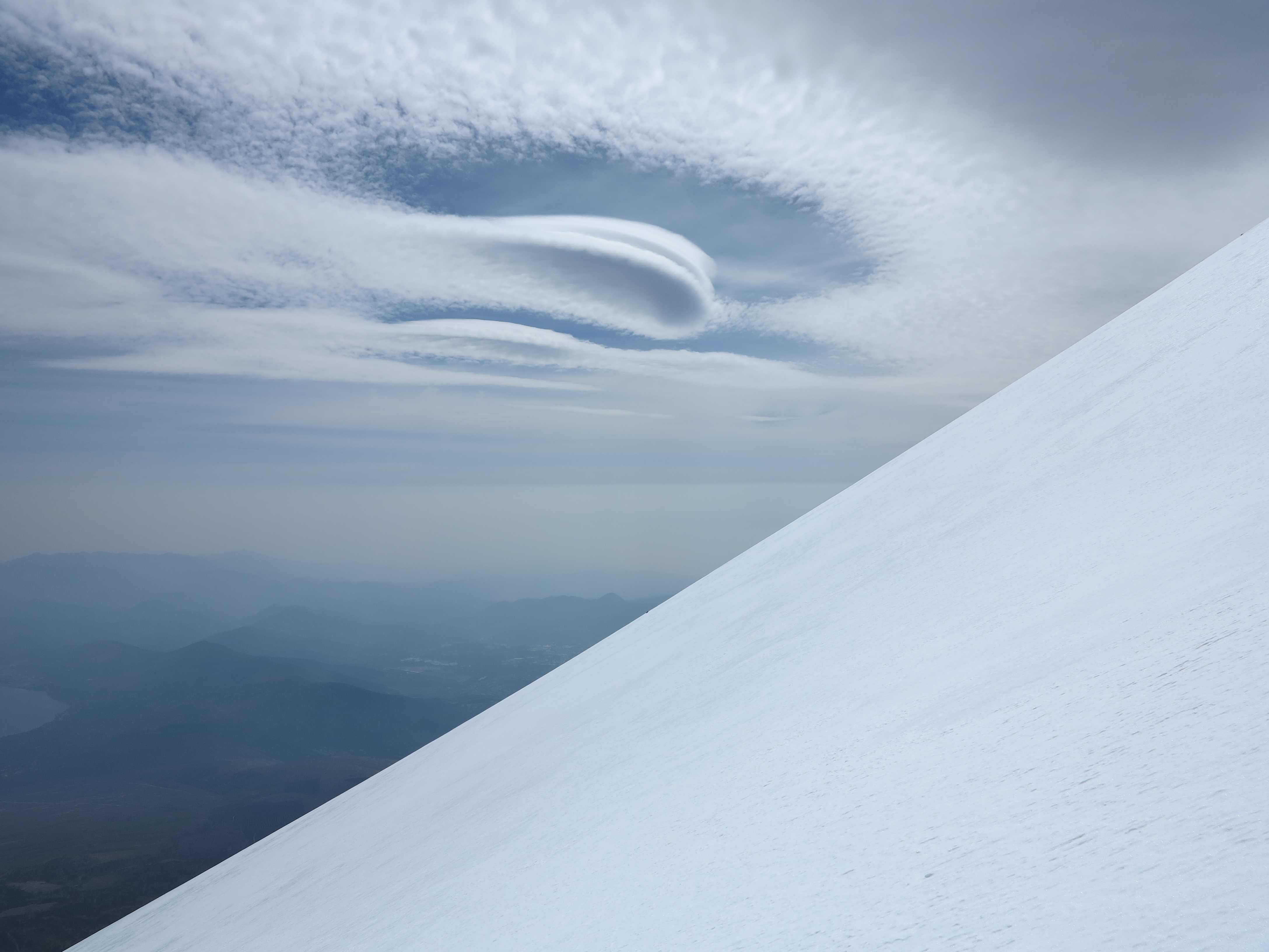
View down the snow covered flanks of the mighty Fuji-san.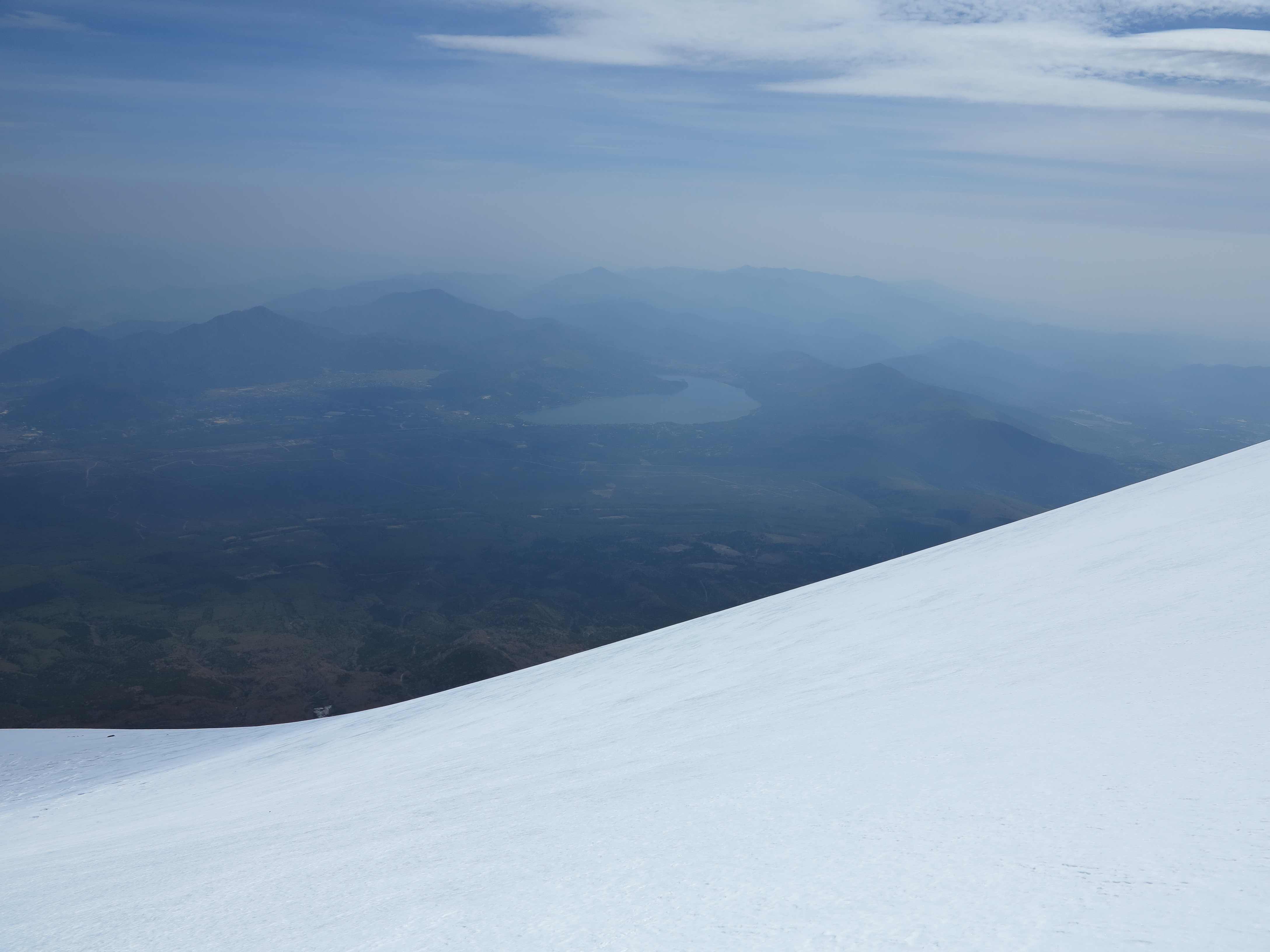
After 5 hours we reached the crater rim. And the top was right there…on the other side of the enormous crater! 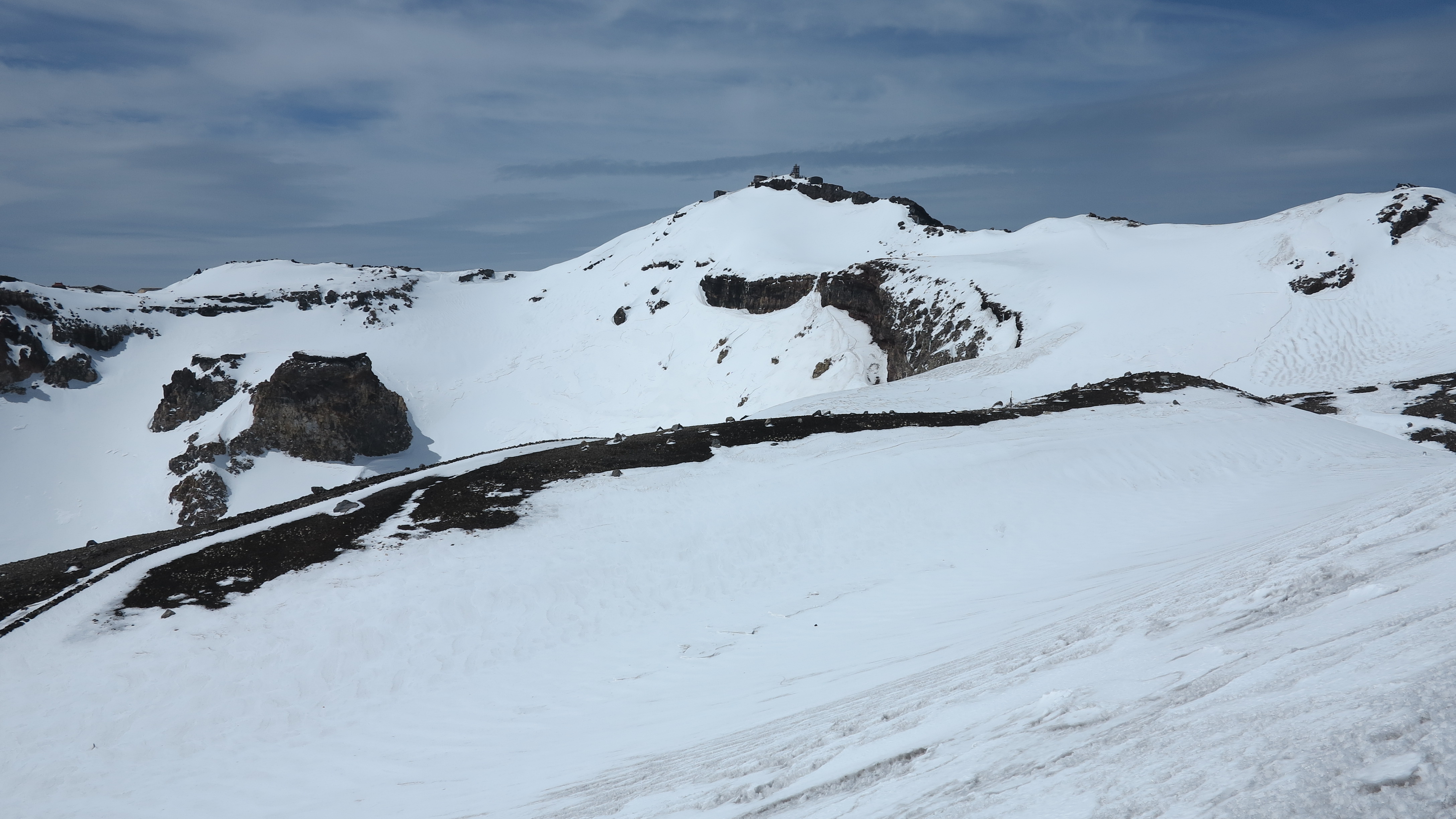
Finally arrived at the true top of Fuji-san, 3776 m. We were slightly tired!
Marco-san at the summit. 
And the wife! 
View down the southern slope of Mount Fuji. Steep! An ice cold wind was blowing. 
We made the round trip of the impressive crater of Fuji-san. 
A Japanese shrine on the crater rim. 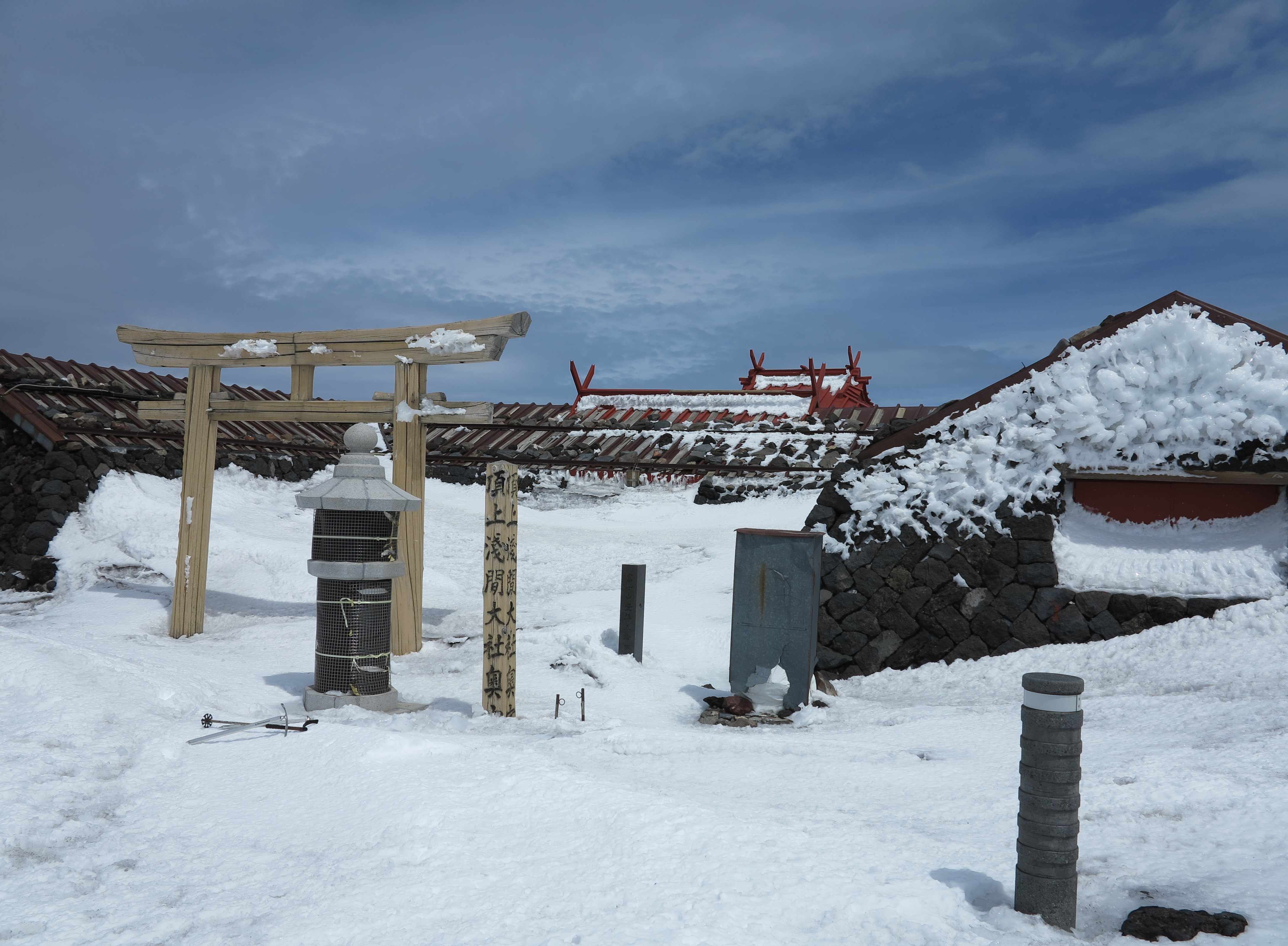

And then we headed down, looking forward to an easy descent but instead we found the steep slope so icy that we had to practice ice climbing with the ice axe and the tip of the crampons for the first 150 m. Some very delicate moments! The rest of the way down we had to pay a lot of attention not to slip and fall down the slope. Therefore no pictures! In the photo below we are down at the base of the slope with the legs very tired….only to find that we had to crawl through this bloody tunnel which had been half filled with snow during the winter. Poor the legs!
Gradually the weather had gotten worse, the wind had picked up and when we were almost down it started snowing. And this is what Fuji-san looked like when we were back at the car. We were very lucky and enjoyed a hard but brilliant day on one of the most beautiful volcanos in the world. 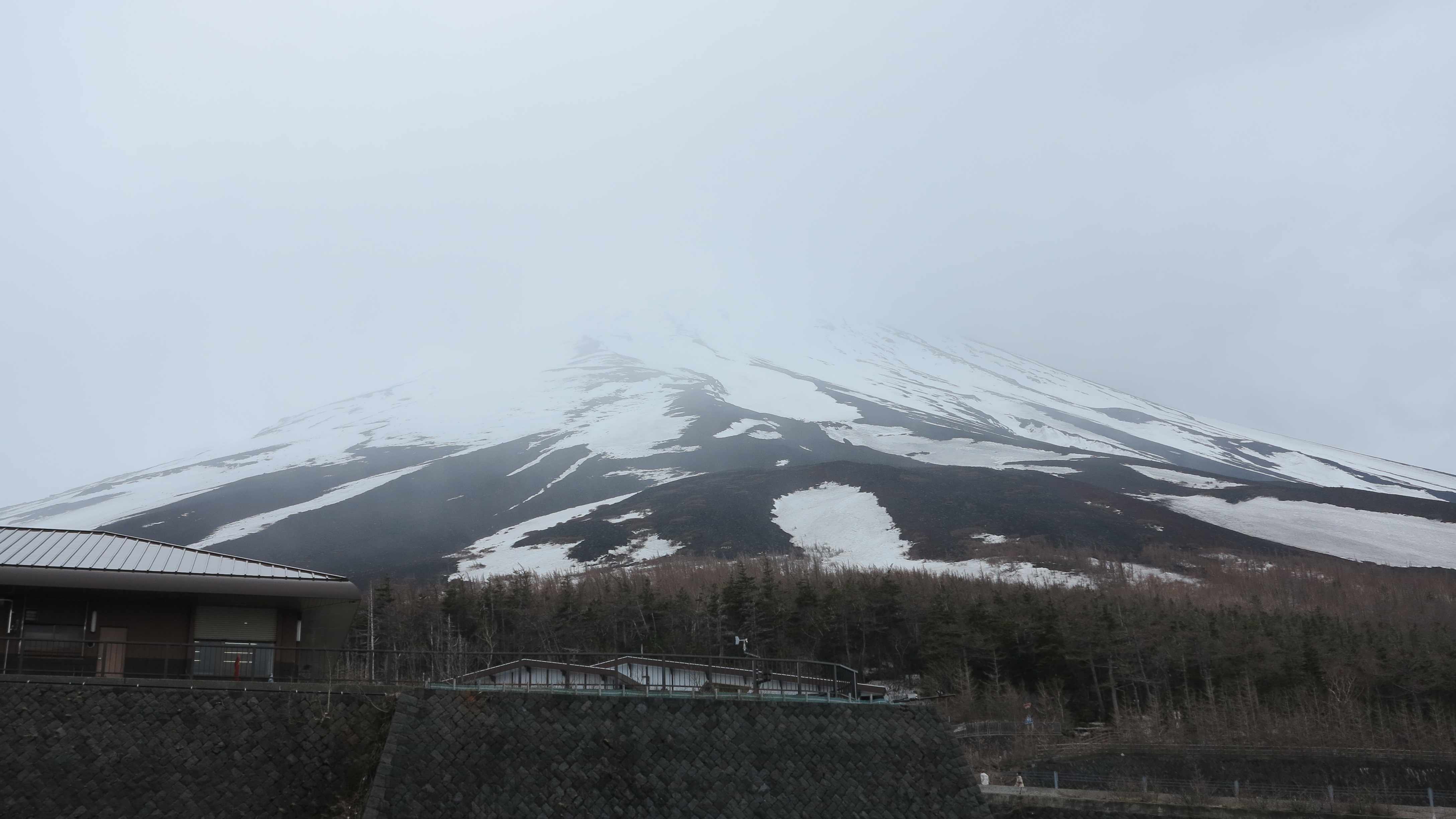
And look what Yuko, Dani and Nico had made for us when we came home 🙂
_________________________
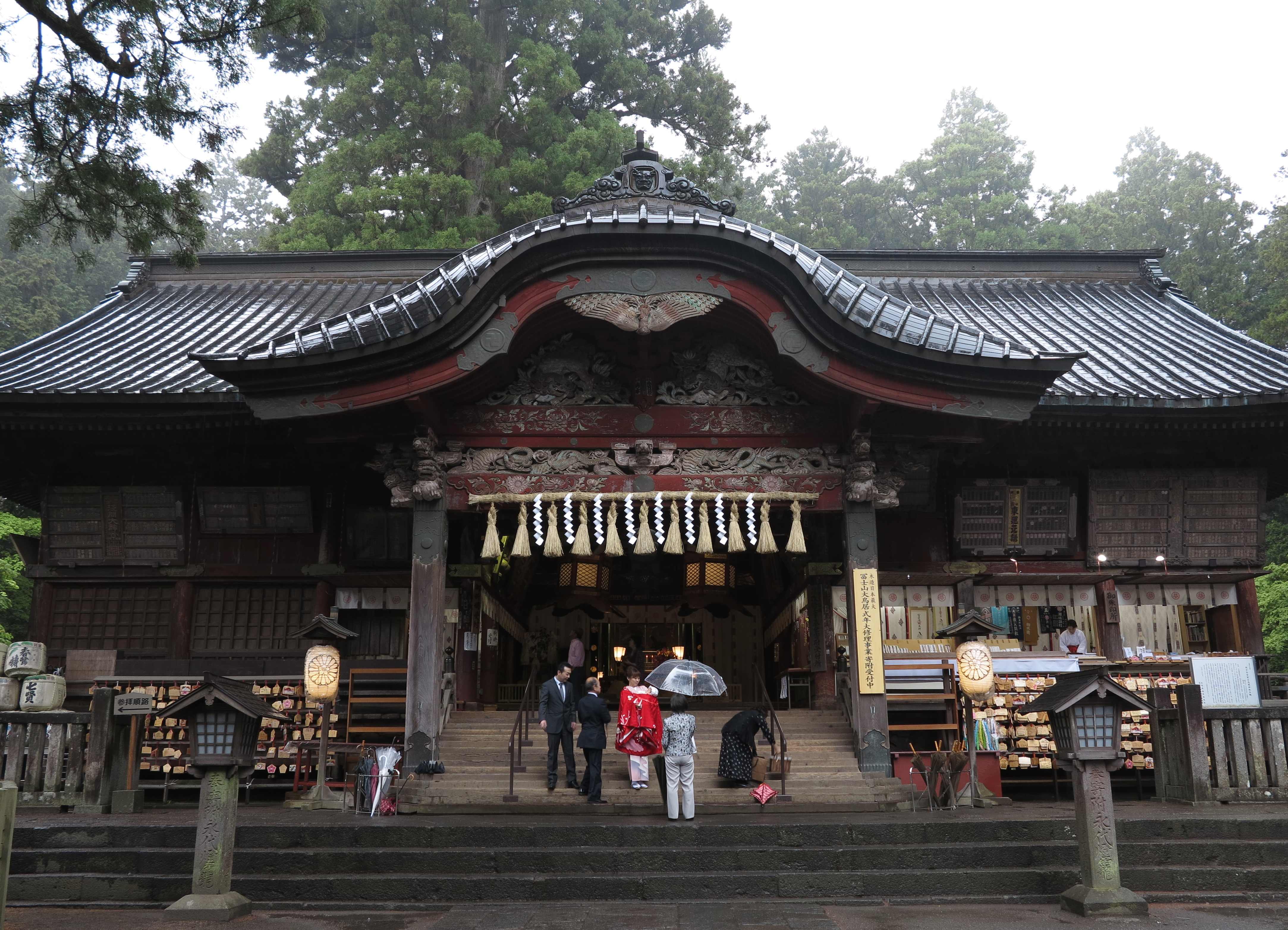
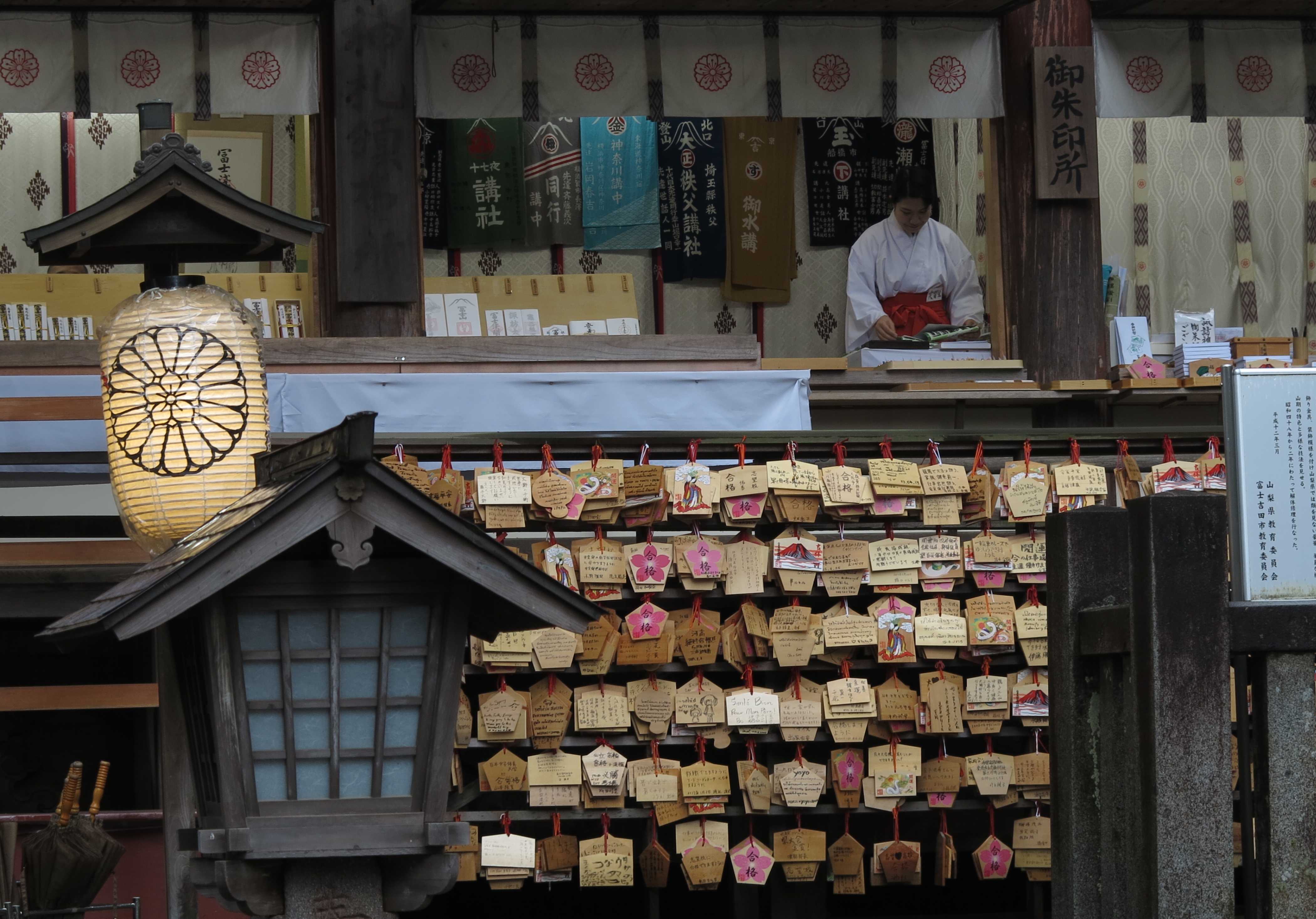
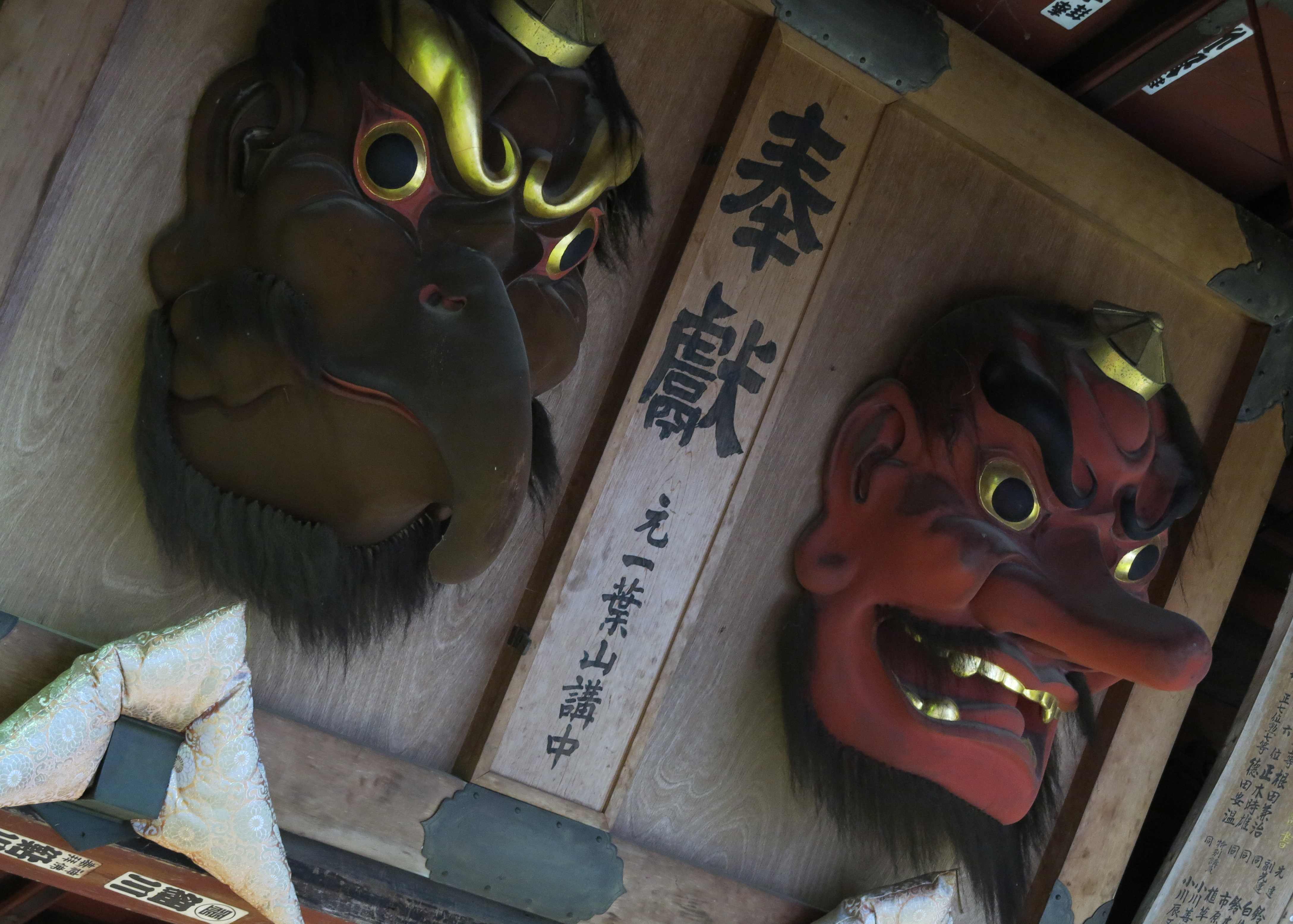
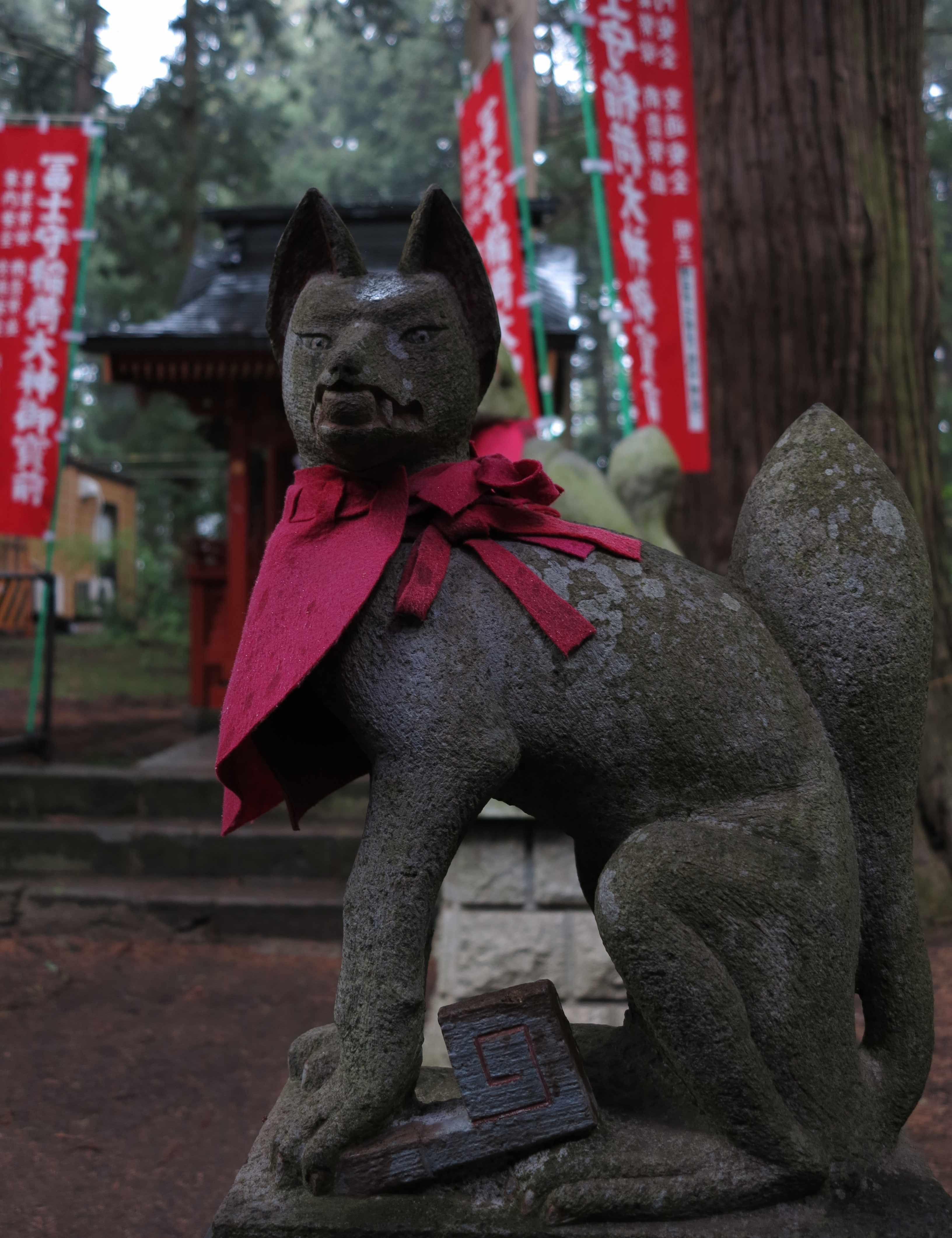
Kitaguchi Hongu Fuji Sengen Jinja Shrine in Fujiyoshida
11 May 2013
If you are passing through Fujiyoshida at the foot of Mt Fuji, do not miss out on the very atmospheric Fuji Sengen Jinja Shrine, dedicated to the official Shinto Goddess of Mt Fuji. 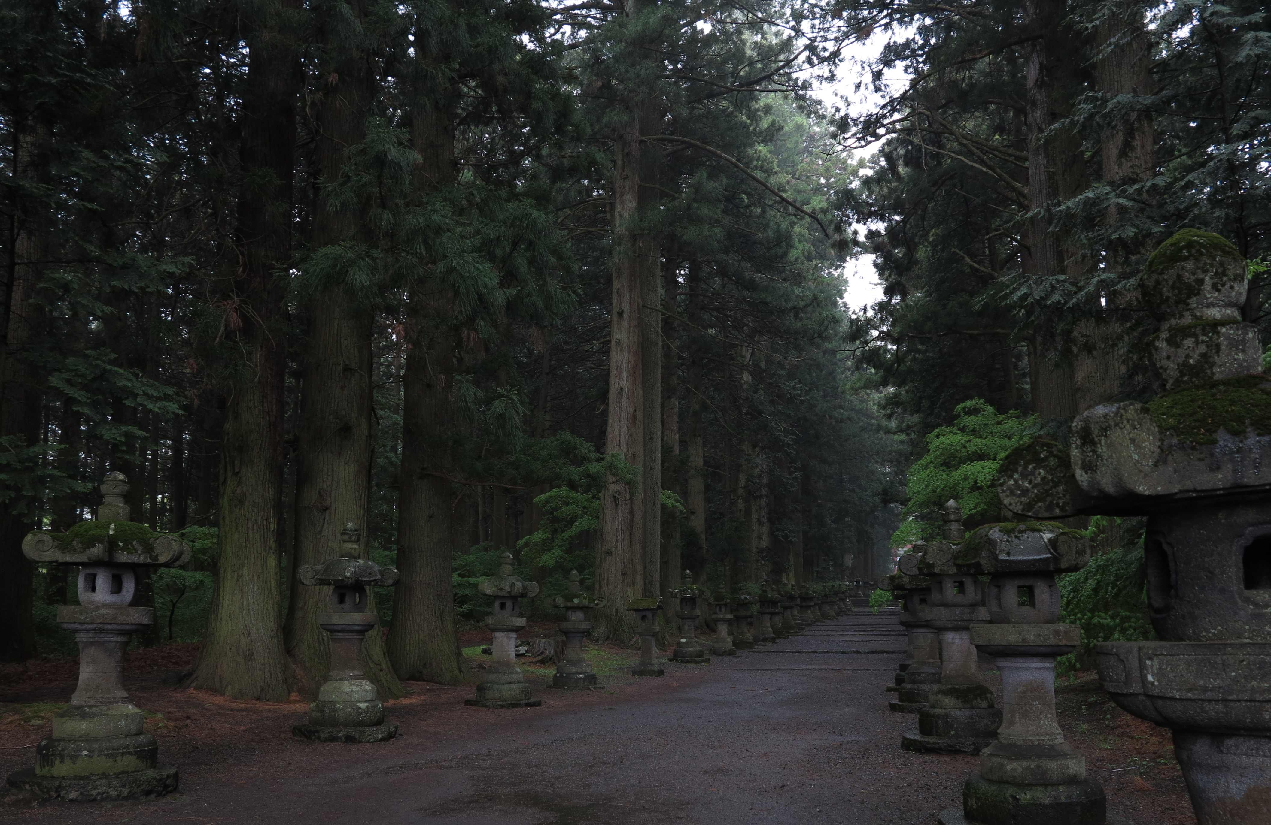
Woman praying at one of the three remaining sacred trees, which are over 1000 years old.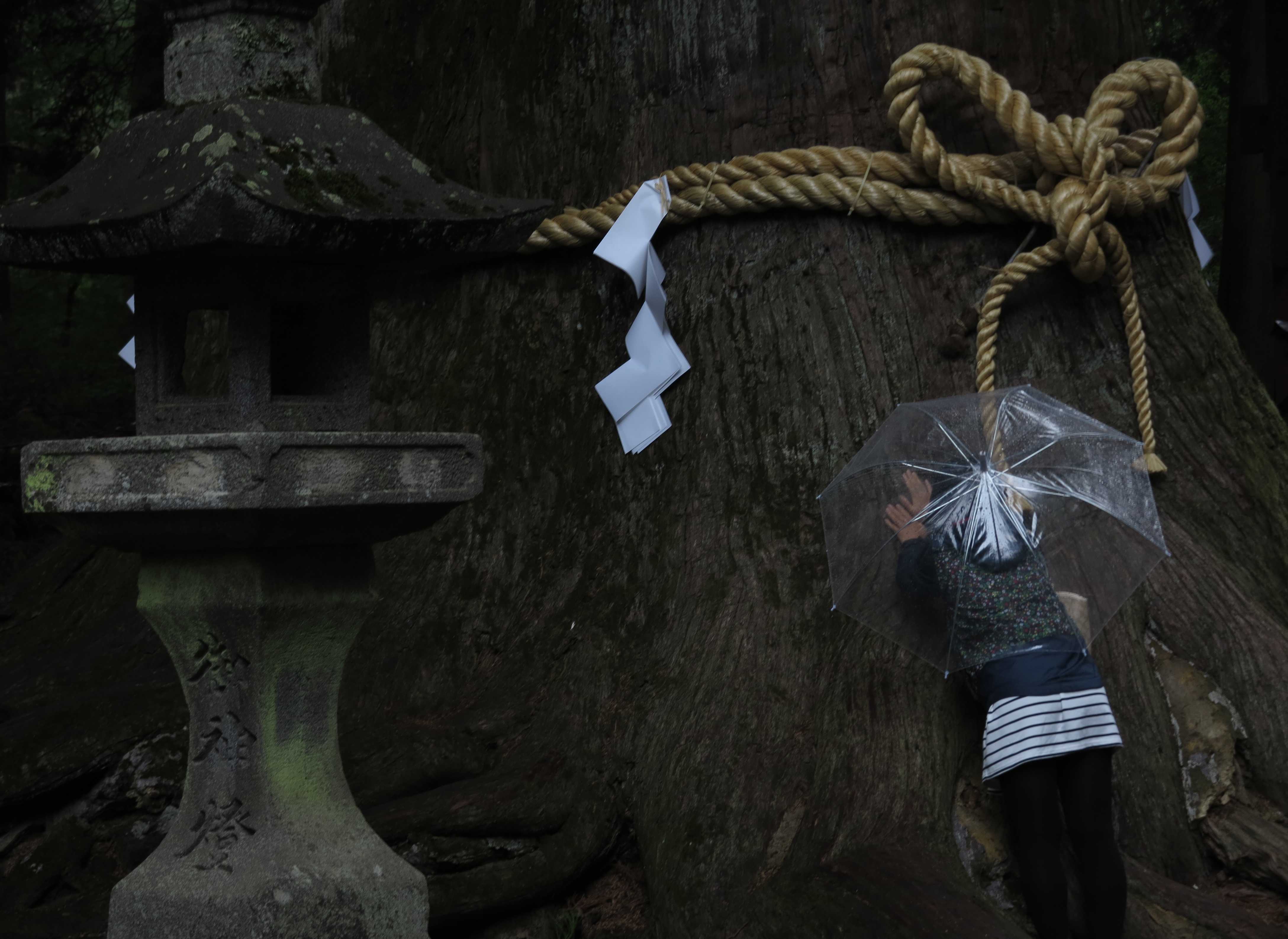


________________________
Great East Japan Earthquake and Tsunami
16-17 May 2013
It is more than two years since a magnitude 9.0 earthquake struck off the coast of Japan on 11 March 2011. The earthquake was extremely strong, the fifth most powerful earthquake in the world since modern measurements began in 1900 and the most powerful earthquake ever to hit Japan. As a result of the earthquake, the main Honshu island of Japan moved 2.4 meter to the east. The epicenter was just 70 km off the coast of the Oshika Peninsular and it triggered enormous tsunami waves which were up to 40 m high when they hit the east coast of Japan. More than 15,000 people died.
All these numbers are incredible. We all saw the pictures on TV. But to drive through the same area now, 2 years later….it left us silent side by side in the car. No words.
We know that our photos will not be able to convey our feelings. We took mainly snapshots out of the car window and the quality is not very high. In the worst areas we were not allowed to enter (just north of the Fukushima Daiichi Nuclear Power Plant). But to understand the size of the disaster, you must remember that we were driving through this landscape of devastation for 2 full days.
___________________________
The first signs that we were entering the area of the tsunami came just north of the city of Iwaki. This is the area which is quite close to the Fukushima nuclear power plant and everything had been left as it was. All the houses were abandoned. The fields were growing wild and weeds were popping up through the concrete and the asphalt. Below, the house escaped the tsunami but notice the car which has been “parked” half way up the wall and the general state of disorder which jumps in your eyes because it is so unusual in Japan. 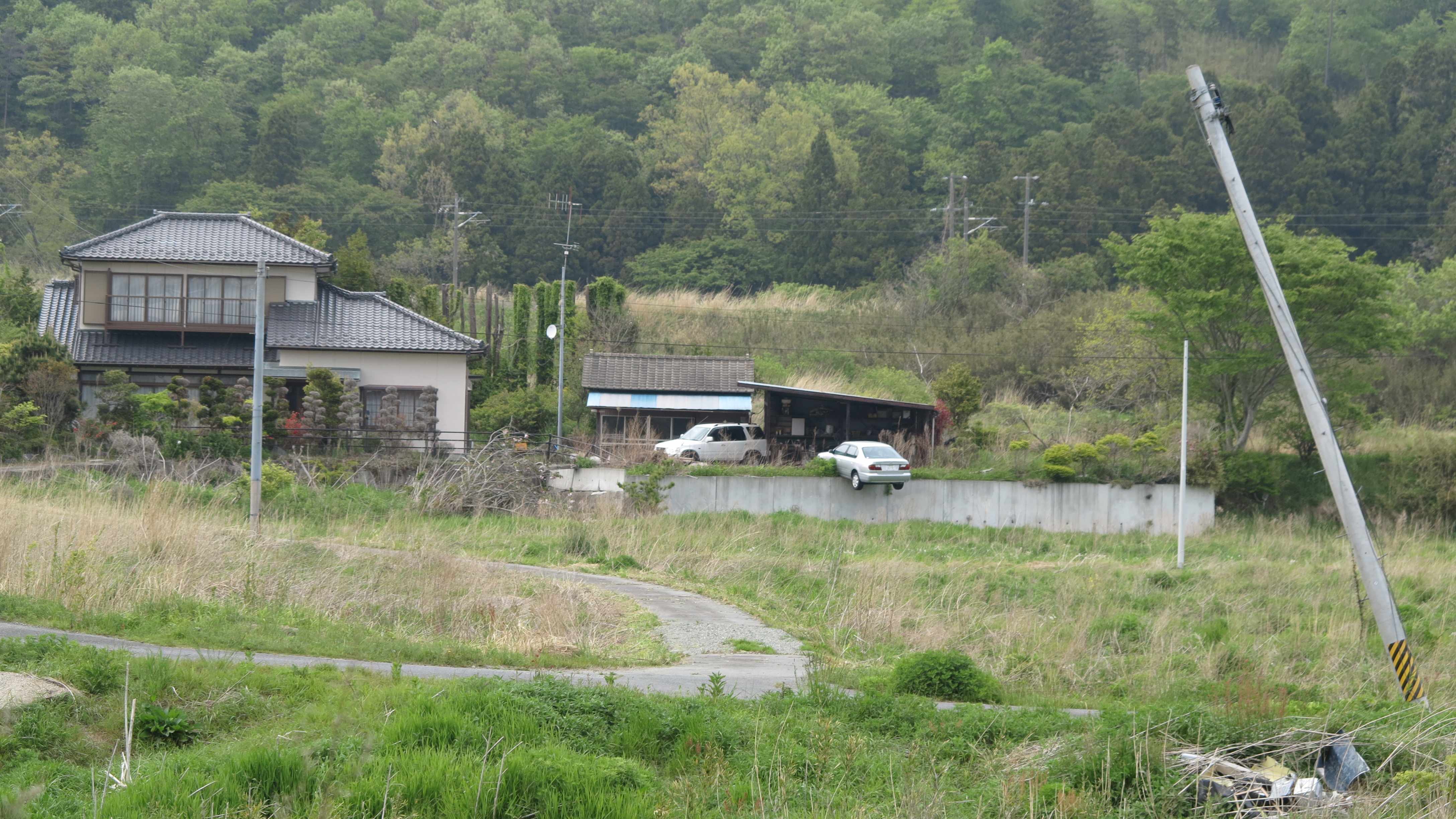
The parking lot of a supermarket and McDonalds. Shortly after passing through this abandoned area we found the road blocked by police. We had to turn around and make a big detour inland up to Sendai. 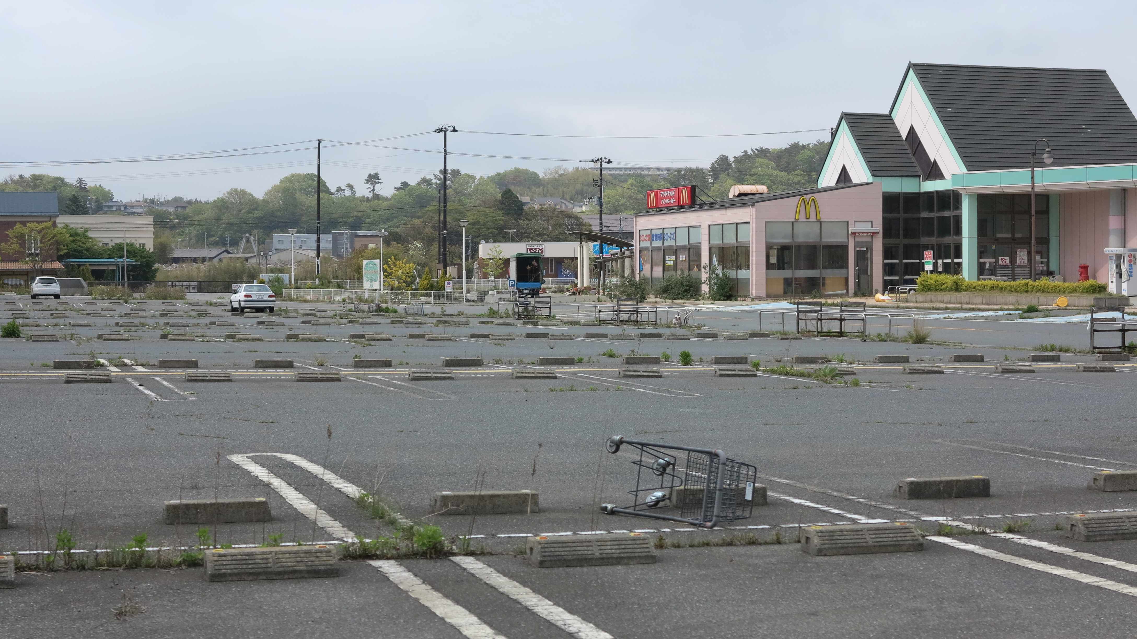
We continued driving along the coast north of Sendai and the famous Matsushima Bay. It is a beautiful coastline full of small bays and inlets and rocky peninsulars. But every time the road dropped down from the hills to sea level, we saw the same depressing view of devastation. Here, a small fishing village used to sit. Now only the temple (in between the trees on the hill to the left) and the concrete foundations of the houses are left. 
A view over the peaceful and beautiful bay. But here the tsunami destroyed everything.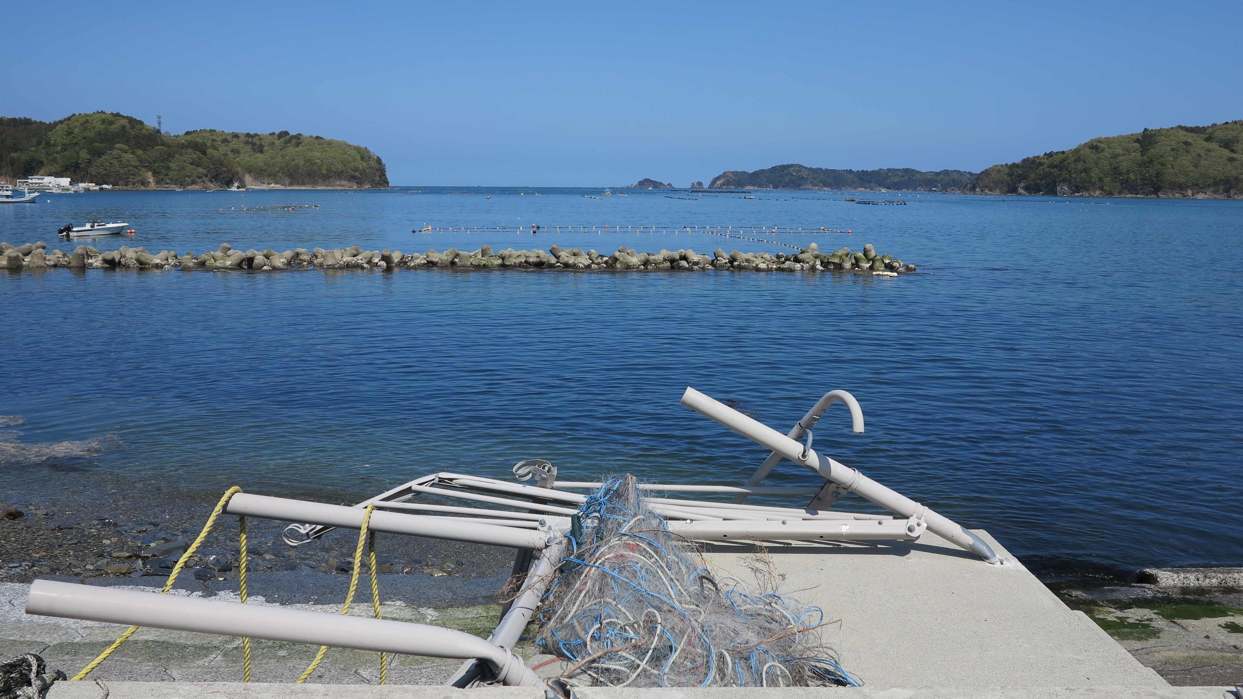
The fishermen are still coming here to work, but now they are living in temporary housing areas up the hill from the original village.
Occasionally we would pass villages like this, which were lucky enough to be on a hill so they escaped the tsunami. Now they are there serving as reminders of what used to be. 
Beautiful view over the tranquil waters. But turn your head to the left or right and you see the empty grounds of the houses that used to be.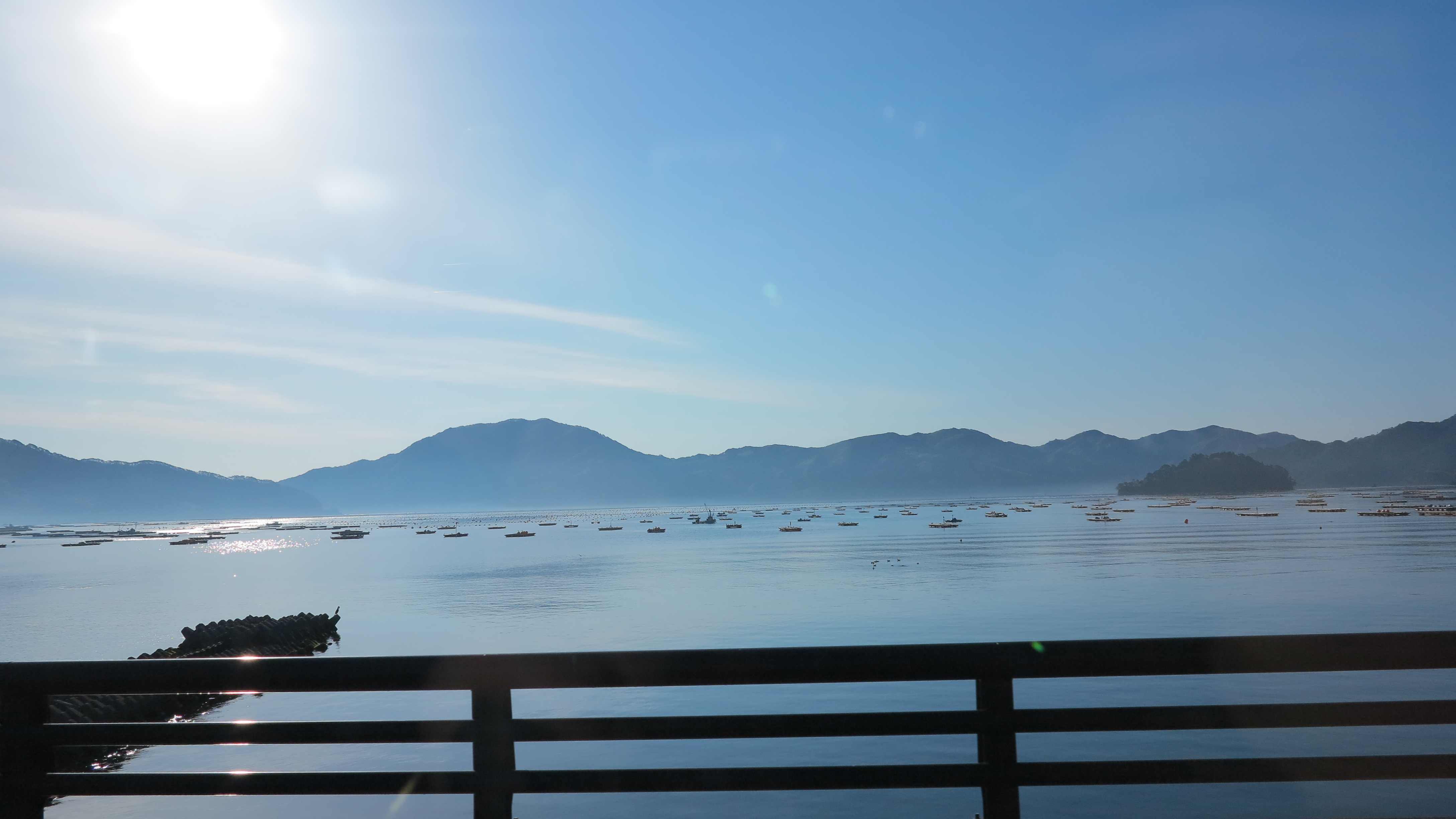
Emptiness in every bay. 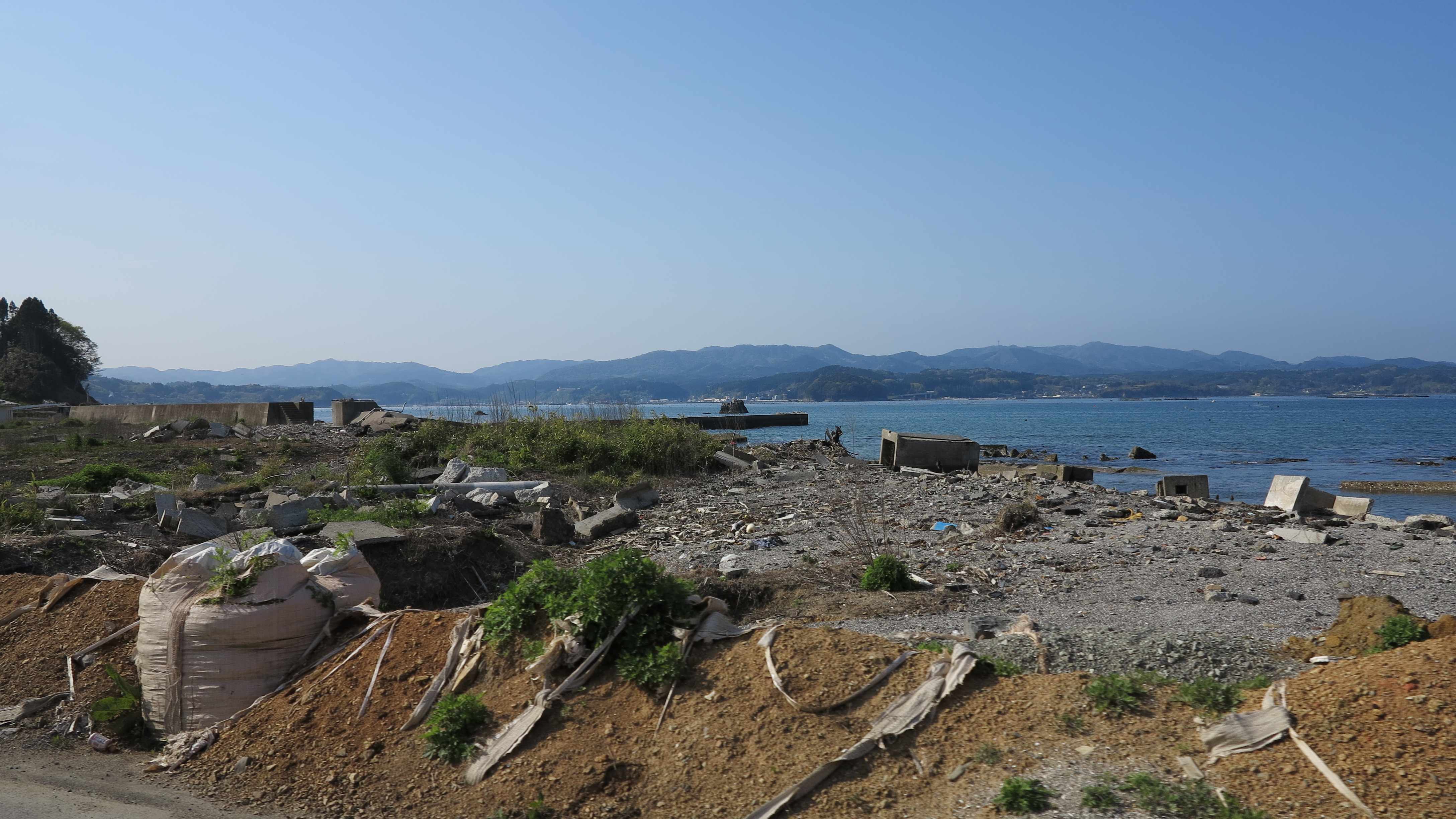
Still so much work to do.
This house is still standing but all the neighbors disappeared. Sometimes the borderline between full destruction and those who escaped was very sharp.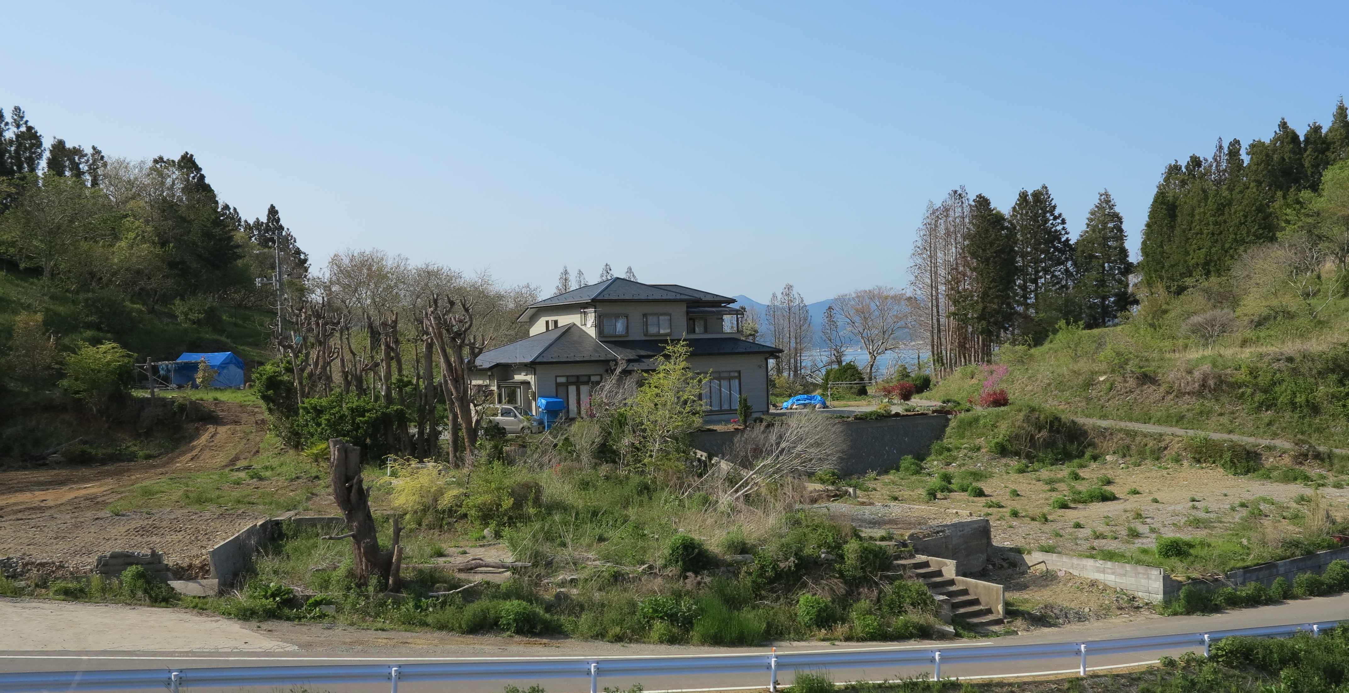
Everywhere were heaps of leftovers from the tsunami.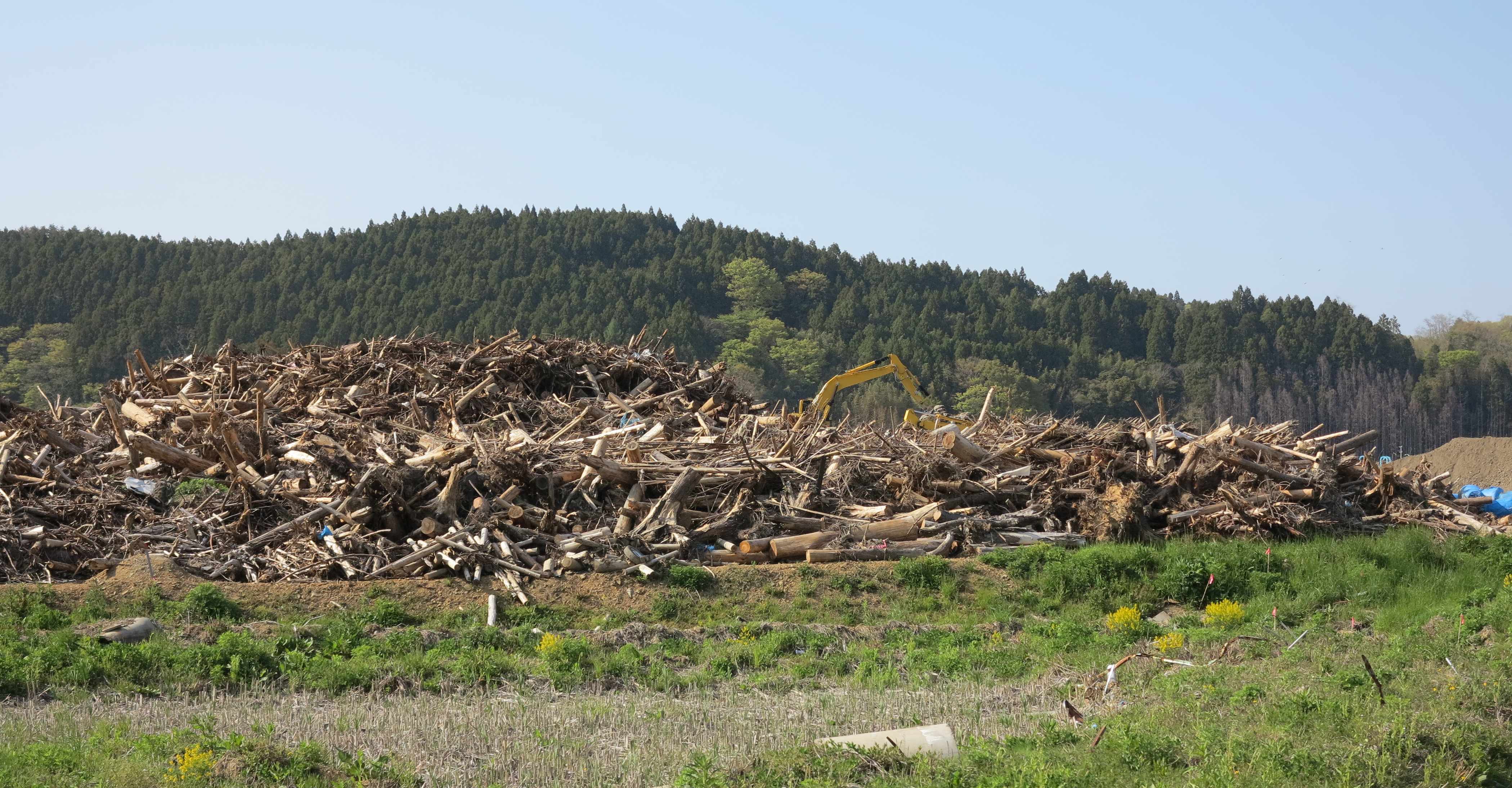

Piles of fishing boats.
Quite a big village used to sit here. When we passed through areas like this we saw the original roads and train lines destroyed and we were driving on temporary roads with total absence of the usual very precise road signs.

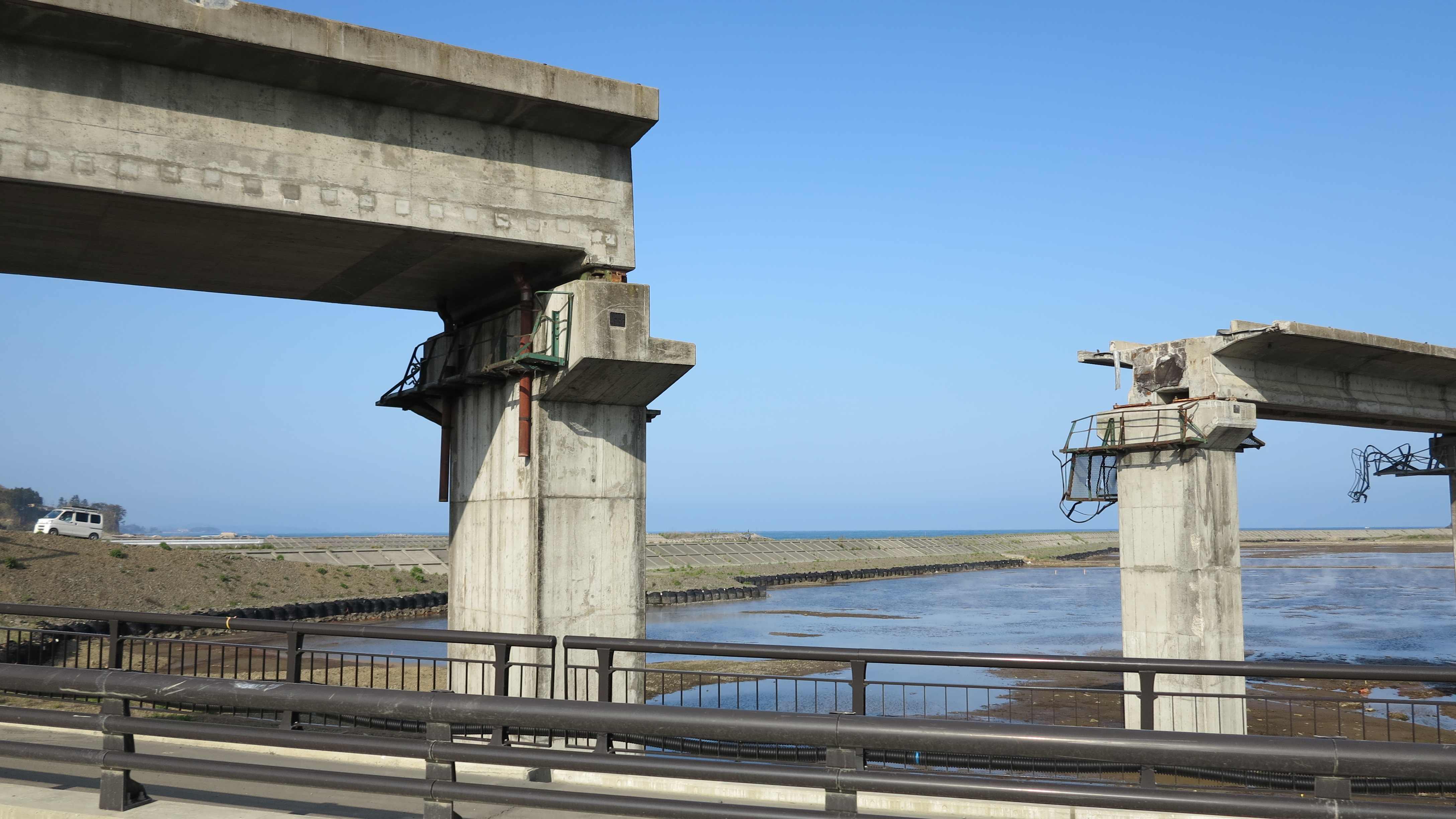
Looking at the previous photos of the destroyed bridges and the photo below with the treeline above the destruction zone, it gives you some understanding of how high the waves were and how far up the land they destroyed everything.
One tree remained standing! Miraculous.
We were almost at the northern end of the Honshu Island, somewhere south of the city of Hachinohe, when finally the signs of the tsunami disappeared. But we will never forget what we saw these two days.
__________________________
Osore-zan – the Mountain of Fear!
19 May 2013
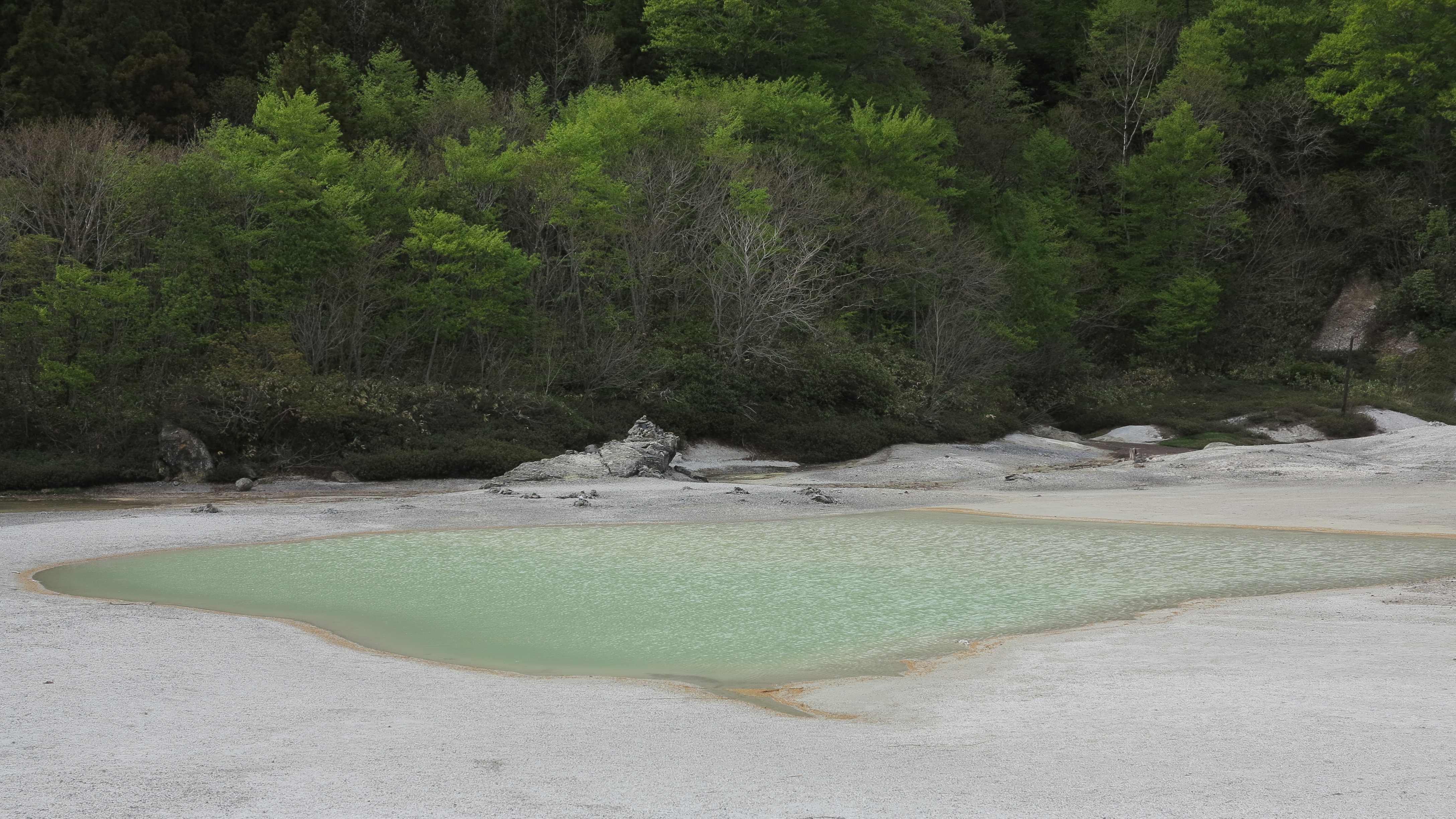
Osore-zan is an ancient holy place on the far northern peninsular of Shimokita Hanto. It is here that the dead souls gather before crossing over to the “other side”. Osore-zan is actually an extinct volcano and it is still emitting large amounts of sulphurous fumes which are coming out of yellow or green hot bubbling ponds and steaming holes in the ground. The whole place stinks of sulphur and the landscape is bleak. Exactly the right setting for the dead souls to hang out!
According to Japanese buddhist tradition, the dead souls have to cross the Sanzu River on their way to the afterlife. The good can cross the river easily by a bridge on their way to the paradise while the bad are unable to pass and are cast into the river.

A buddhist temple, the Osorezan-Bodaiji, was founded on the shores of the crater lake in the 9th century.


Buddha statue carved by the monk who established the Osorezan-Bodaiji temple.

The temple and the surroundings is a lovely place to wander around and forget about time. 

Osero-zan is guarded by Jizo, traditionally seen as the guadian of children and travellers. Lots of small Jizo statues can be seen in the crater of Osero-zan and often people are making offerings to them. According to Japanese ancient beliefs, the souls of children who die before their parents are unable to cross the mythical Sanzu River, because they have not had the chance to make enough good deeds in life and because they made their parents suffer. Every day, these children have to pile stones on the bank of the Sanzu River as a penalty – and every night, demons are destroying the stone piles again. At Osero-zan, one can see lots of stone piles along the shores of the crater lake and people passing are adding a couple of stones to the piles in order to help the children’s souls. Jizo is believed to save these unlucky children’s souls by hiding them from the demons in his robe.
Jizo statues at Osero-zan.


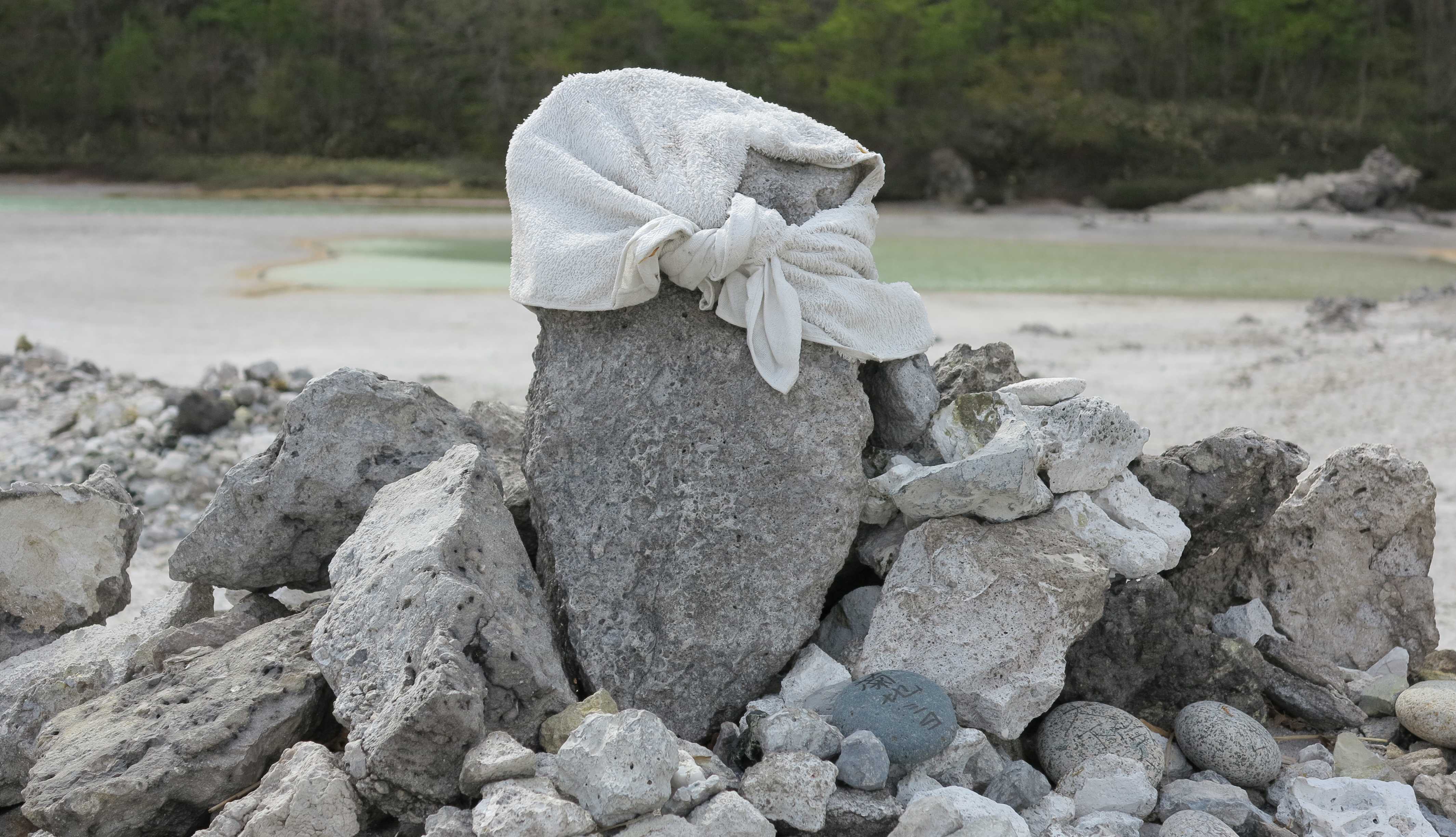


Piles of stones made to help the souls of the dead children.

Sulphur deposits on the shore of the crater lake. 
Stinky and bubbling!


Marco risking one of his fingers in a green bubbling pond.
On one of the hill tops surrounding the crater lake there is also an observatory with a great view over the Shimokita Hanto peninsular.
Probably they are listening to both North Korea and Russia from here! Anyways, the whole place has a bit of a lovely Soviet era feeling over it.
__________________________
Hokkaido
We always wanted to go to Hokkaido since we read A Wild Sheep Chase by Murakami. A strange book but it left us longing for this far northern Japanese island. Hokkaido is not the usual Japan. It is not like Kyoto full of beautiful old shrines and refined Japanese gardens and it is most certainly not like the streamlined, fast paced and metropolitan Tokyo. Hokkaido reminds us a bit of Siberia. It is not so ordered, not so beautiful, but it has its own, more untamed and casual charm.
We took the ferry from Aomori to Hakodate. It was a grey and beautiful day!
There is not so much to see in Hakodate but they have an excellent museum on the original northern people of Japan, in particular the Ainu people. And then we went to see the Russian church. 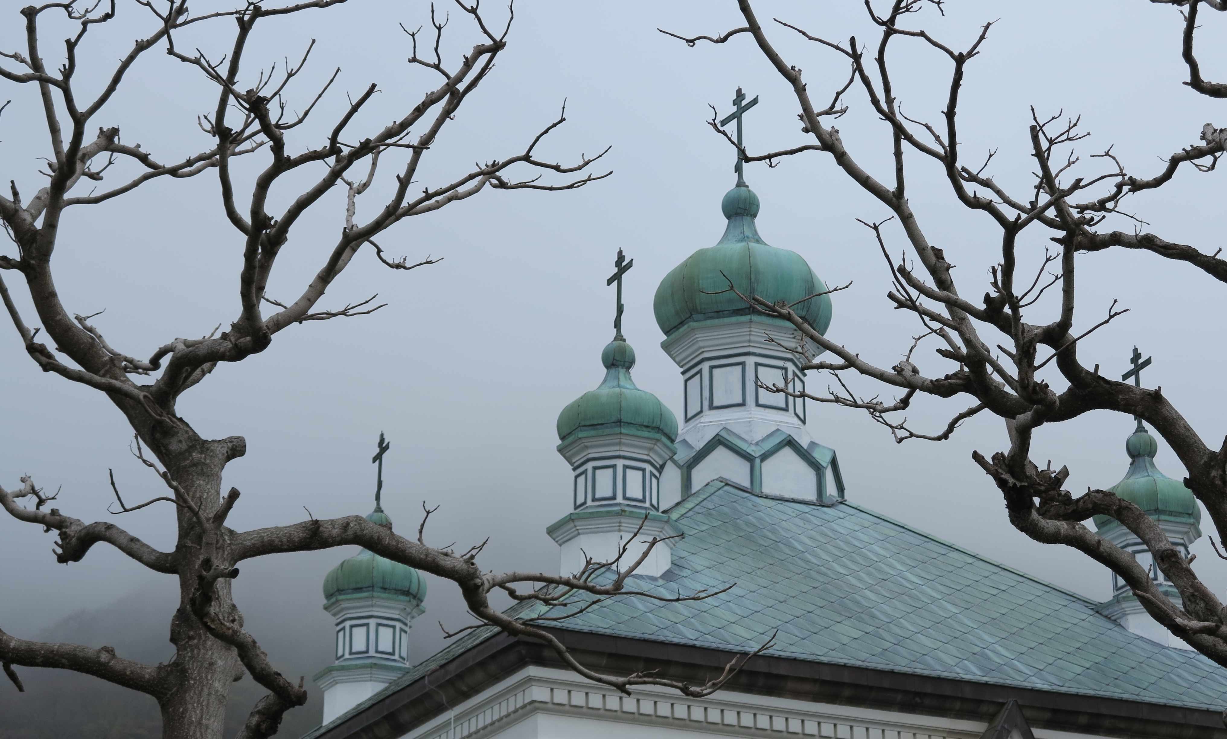
Toilets! Like a small house in the Siberian taiga.
A private home. 
Hakodate is the right place to eat fresh seafood! But it is difficult…. Either the food is too cute…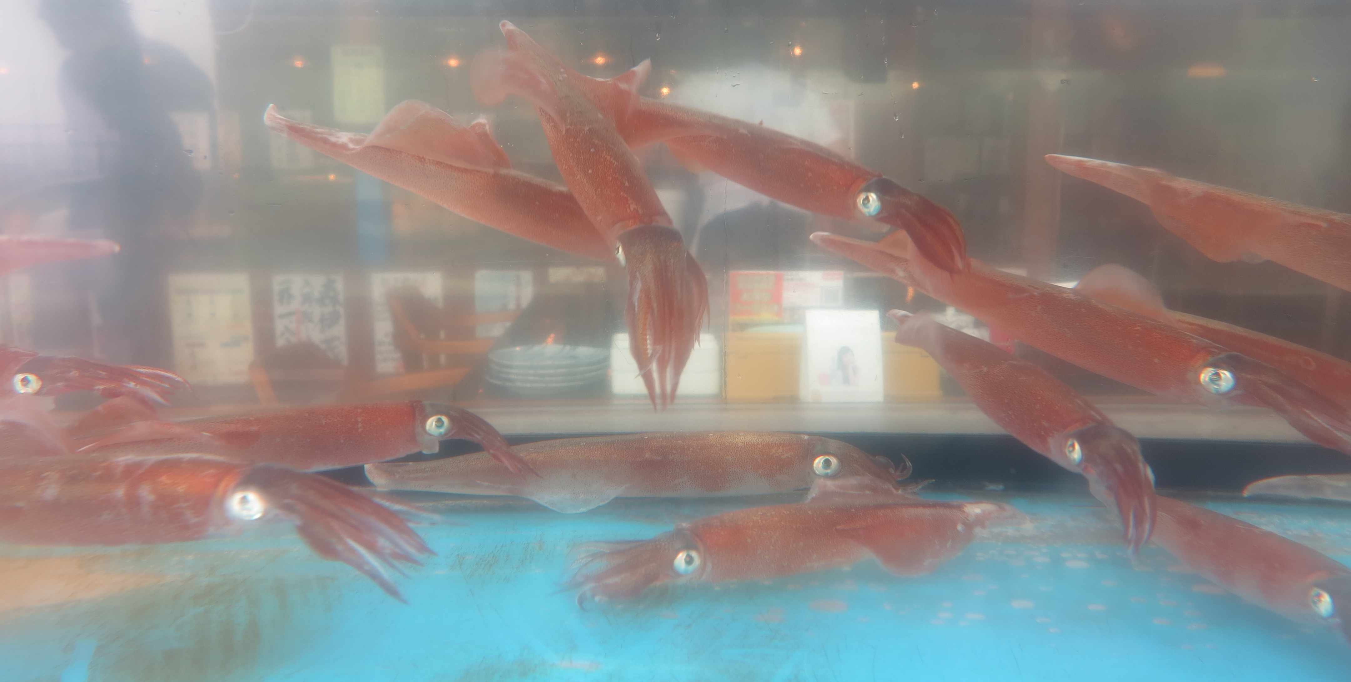
Or it is too ugly…. 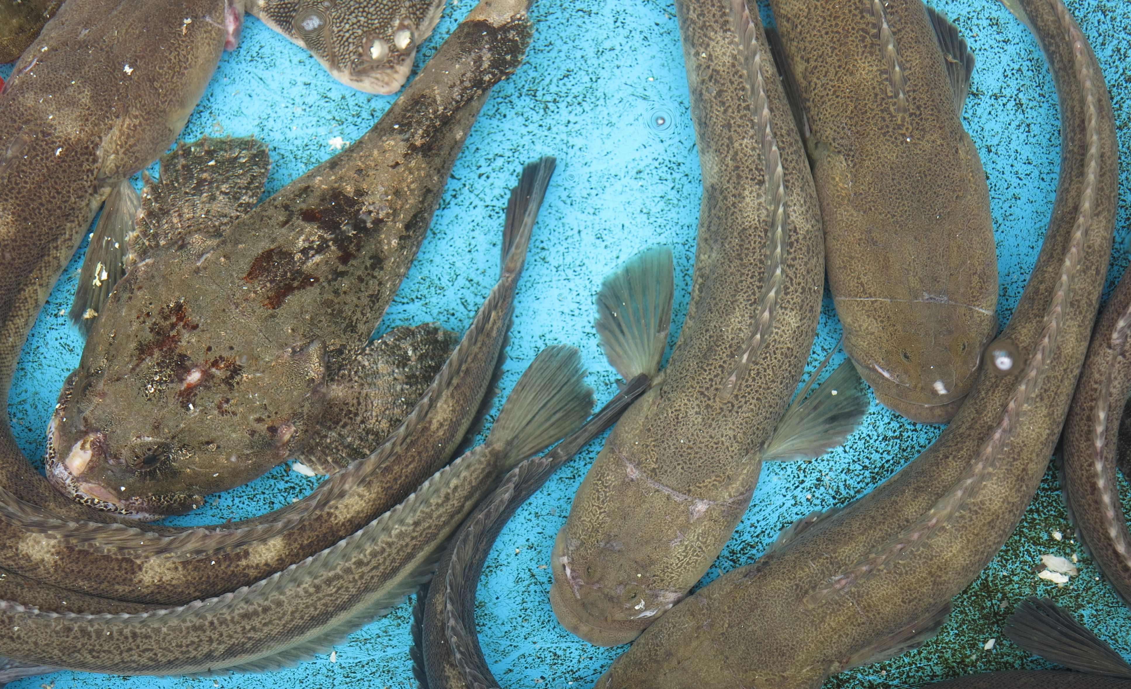
Or it made you blink first! 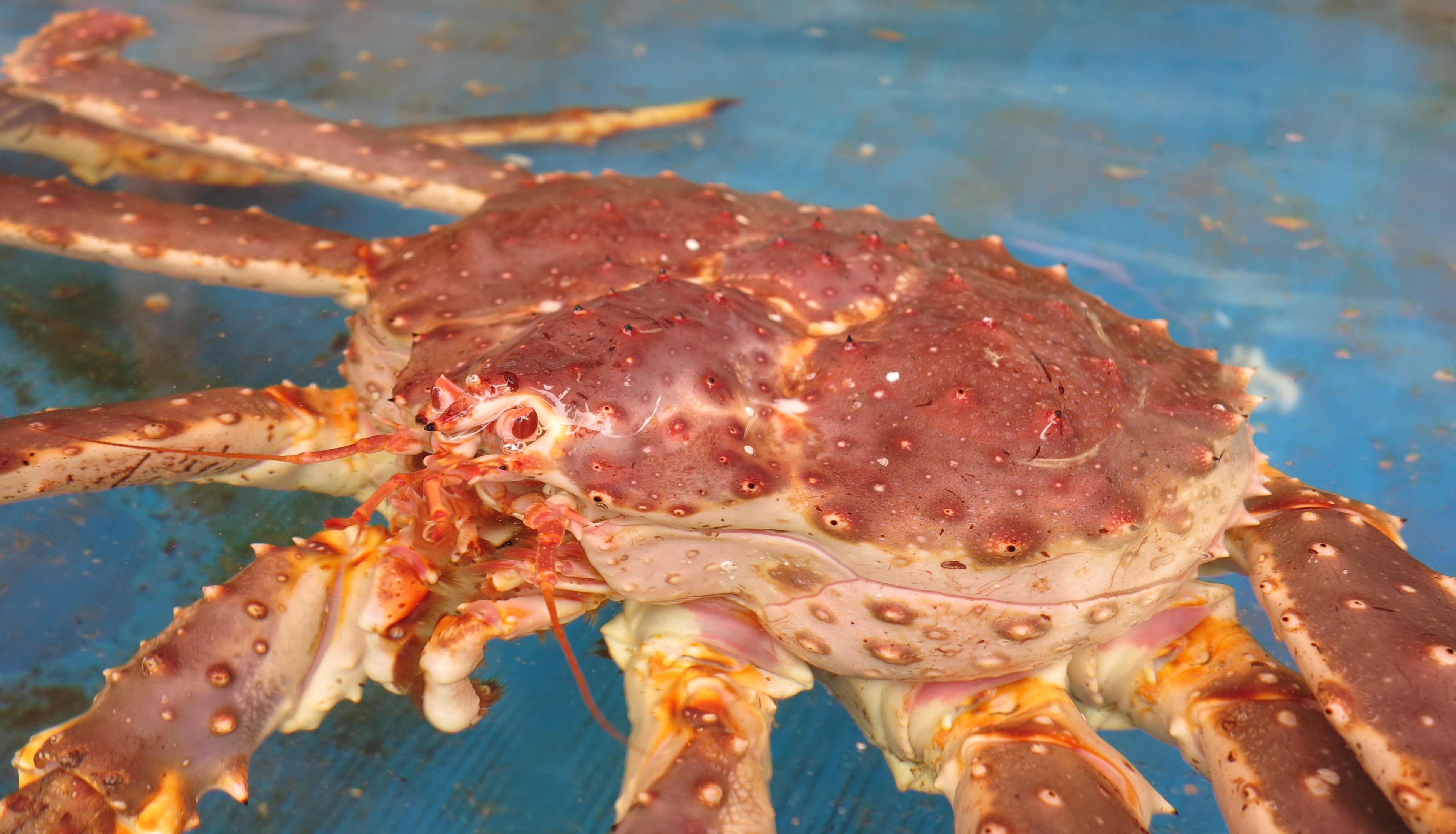
Or it is just so magically beautiful! 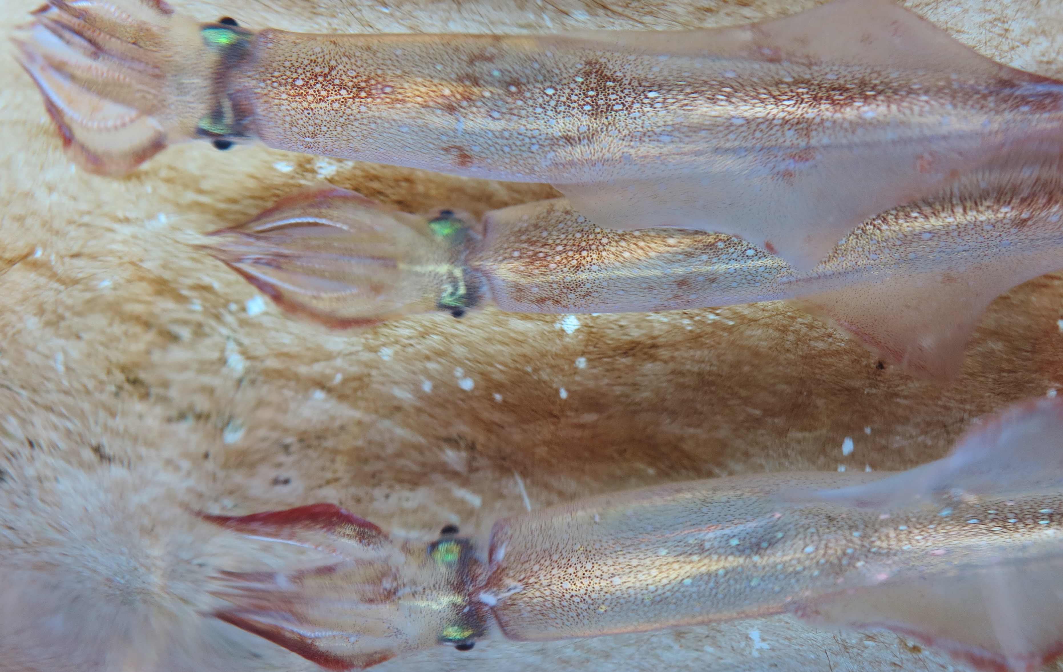
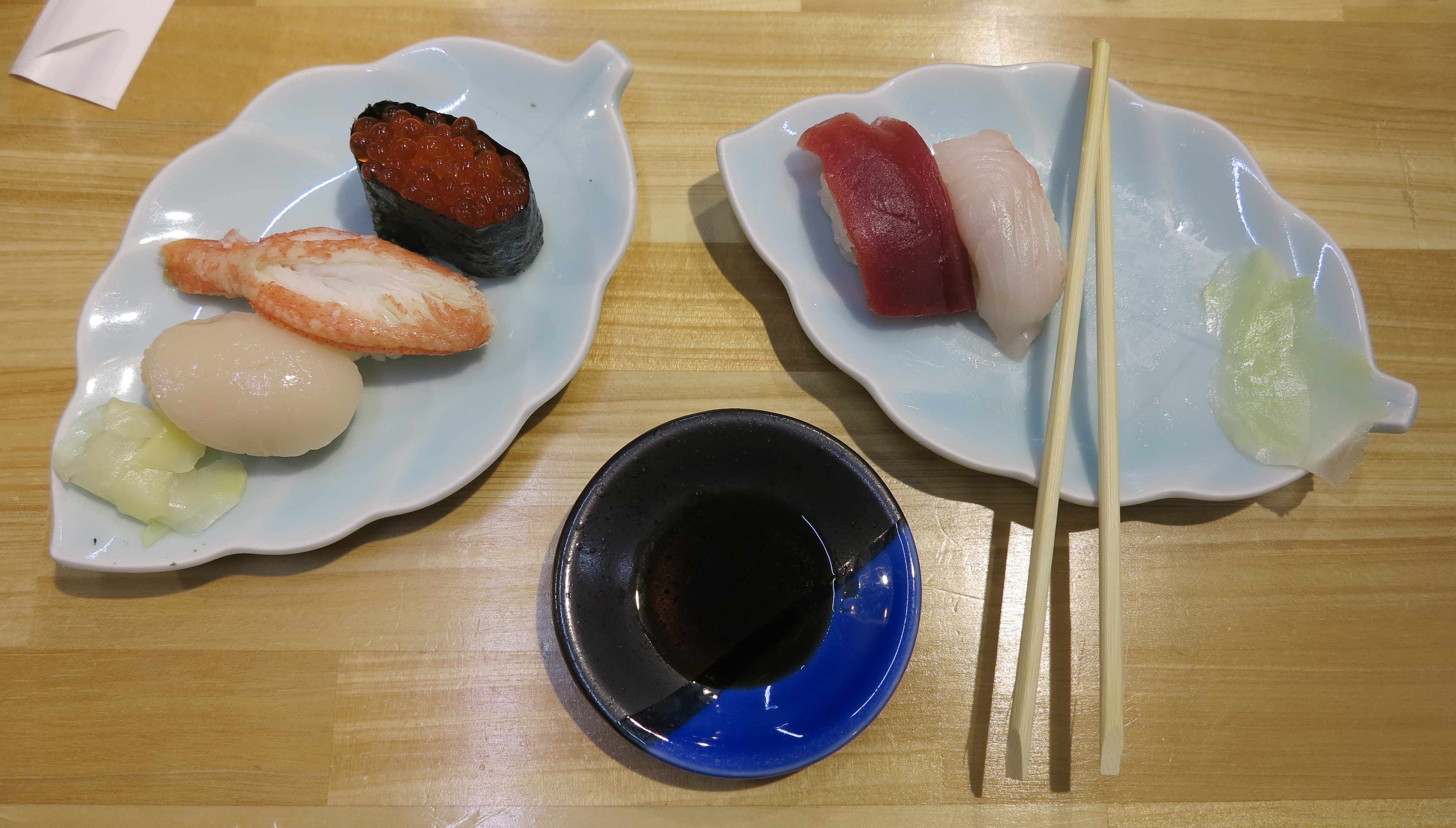
In the end we dit manage to eat some sushi. At least we did not see it being caught.
Then we drove up to the Yosei mountain and spent a lovely quiet night at the foot of the volcano. But unfortunately the weather was too bad for climbing it. So we continued to Sapporo. In Sapporo, we ate fantastic barbequed lamb and we went to the botanical garden. Here ladies and magnolias. 
Inside the botanical garden was a fantastic, very old fashined and beautiful museum showing the wildlife of Hokkaido. Here the Ezo Bear / the Hokkaido bear! 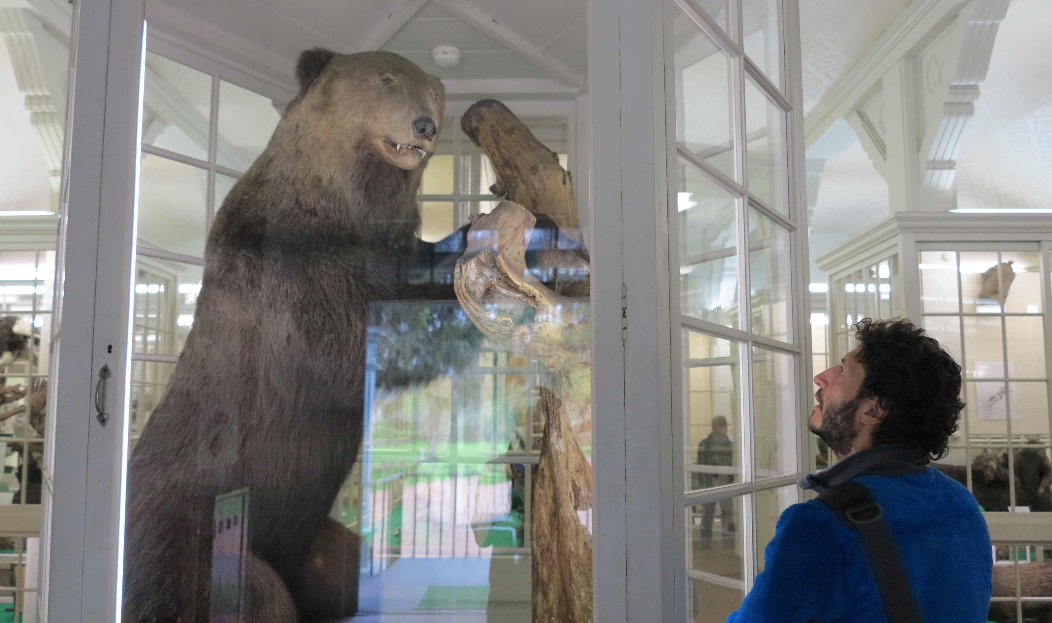
The Ezo / Hokkaido wolf. 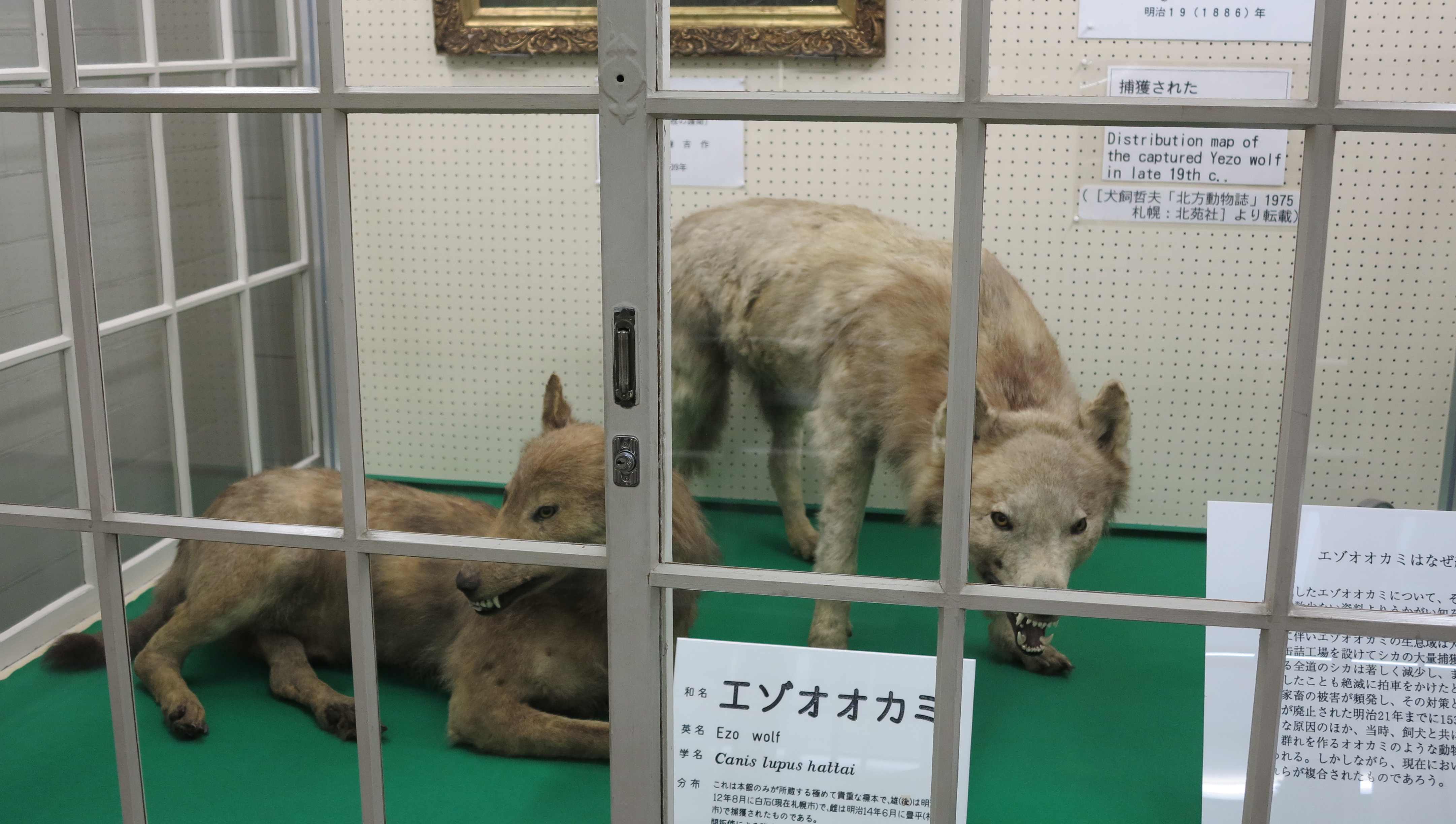
A lovely display of birds with handwritten notes tied around their feet. 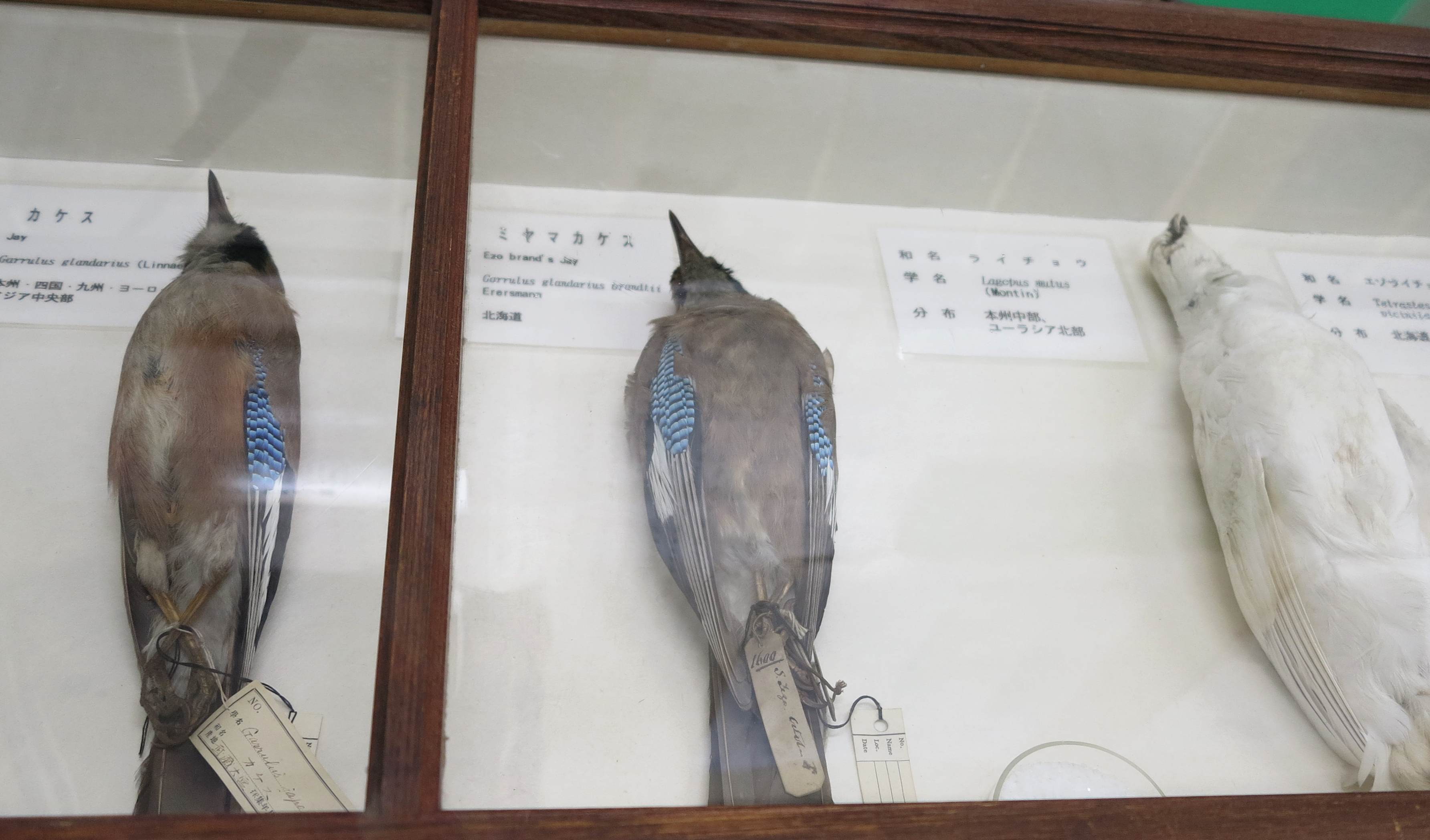
There were also old buildings from the first Japanese settlement of Hokkaido. 
And finally we went to the historical village of Hokkaido, an open air museum with buildings from 1868 to 1926, the main period of settlement of Hokkaido. 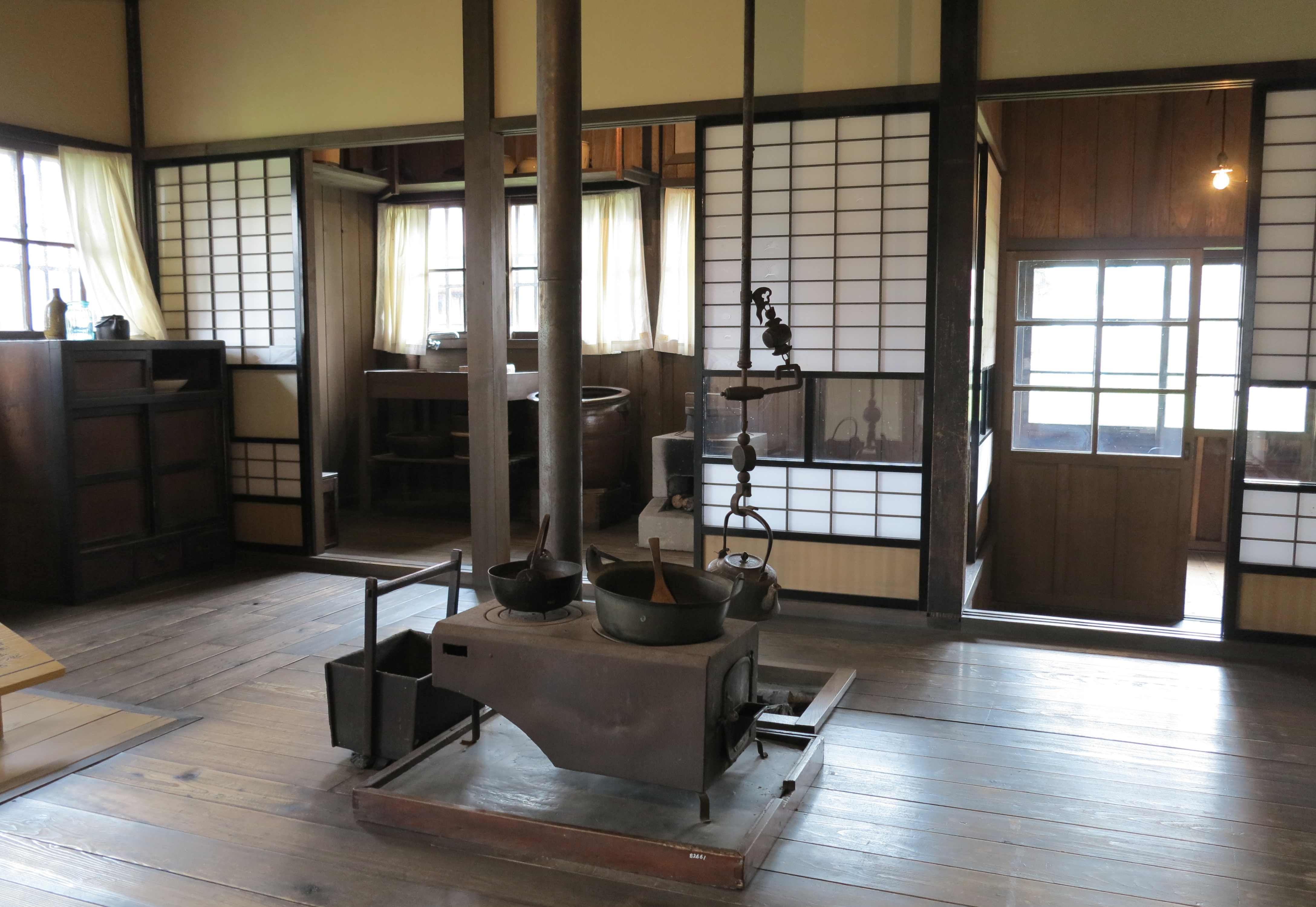
From the old school building. 
Storage of sake. 
Storage of rice. 
Private home. 
Now we have headed northeast, to the mountaineous center of Hokkaido. Here is still meters of snow but also lots of hot springs so we will enjoy as much as we can. Photos and more updates later!
_______________________
Mount Asahidake – Skiing in May!
Central Hokkaido, 23-24 May 2013
At 2,290 m, Mount Asahidake is the tallest mountain on the island of Hokkaido. Naturally, we had to attempt to climb it.
Asahidake is an extinct volcano, which is still emitting stinky sulfur fumes and generating numerous hot springs at its feet.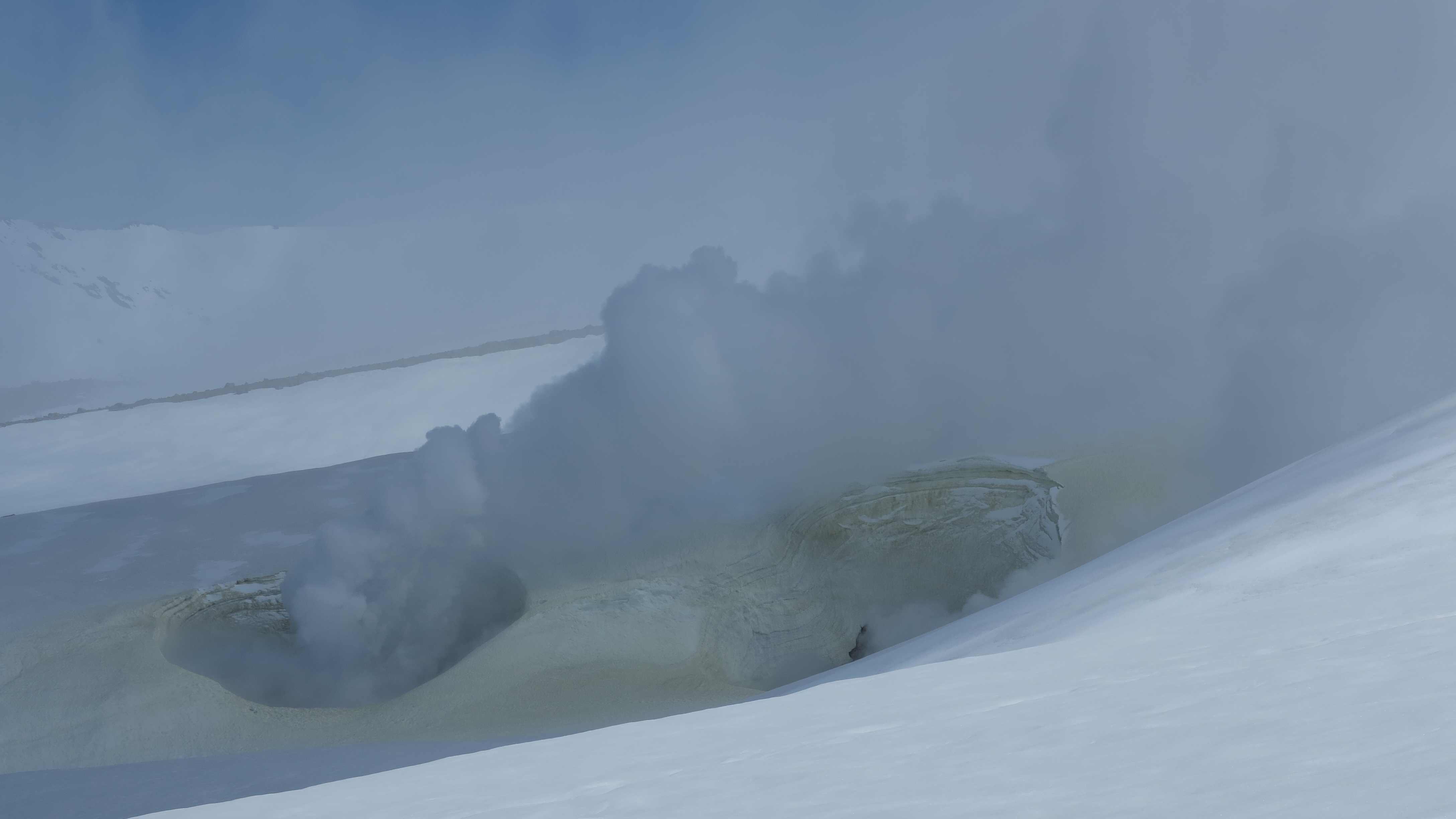
Hokkaido had a lot of snow this year and we were so happy to finally be able to use our skis again, first time since Canada! At 1,500 m we were still measuring around 3 m of snow, which made the wife an amazing 4.9 meters tall.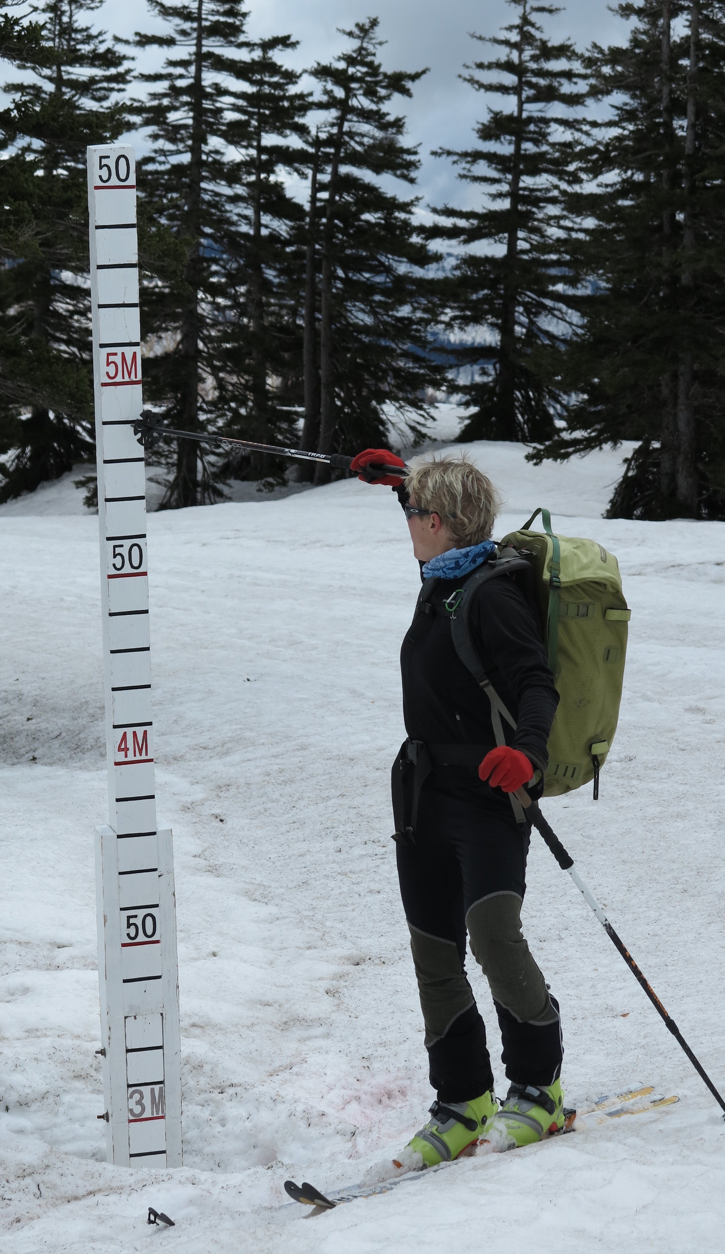
The snow at the parking lot was taller than Frida.
The first day we just went up the slopes of the small ski resort to the cable car station. It was too foggy and rainy to make an attempt at the summit but nevertheless we enjoyed the day and the beautiful winter landscape.
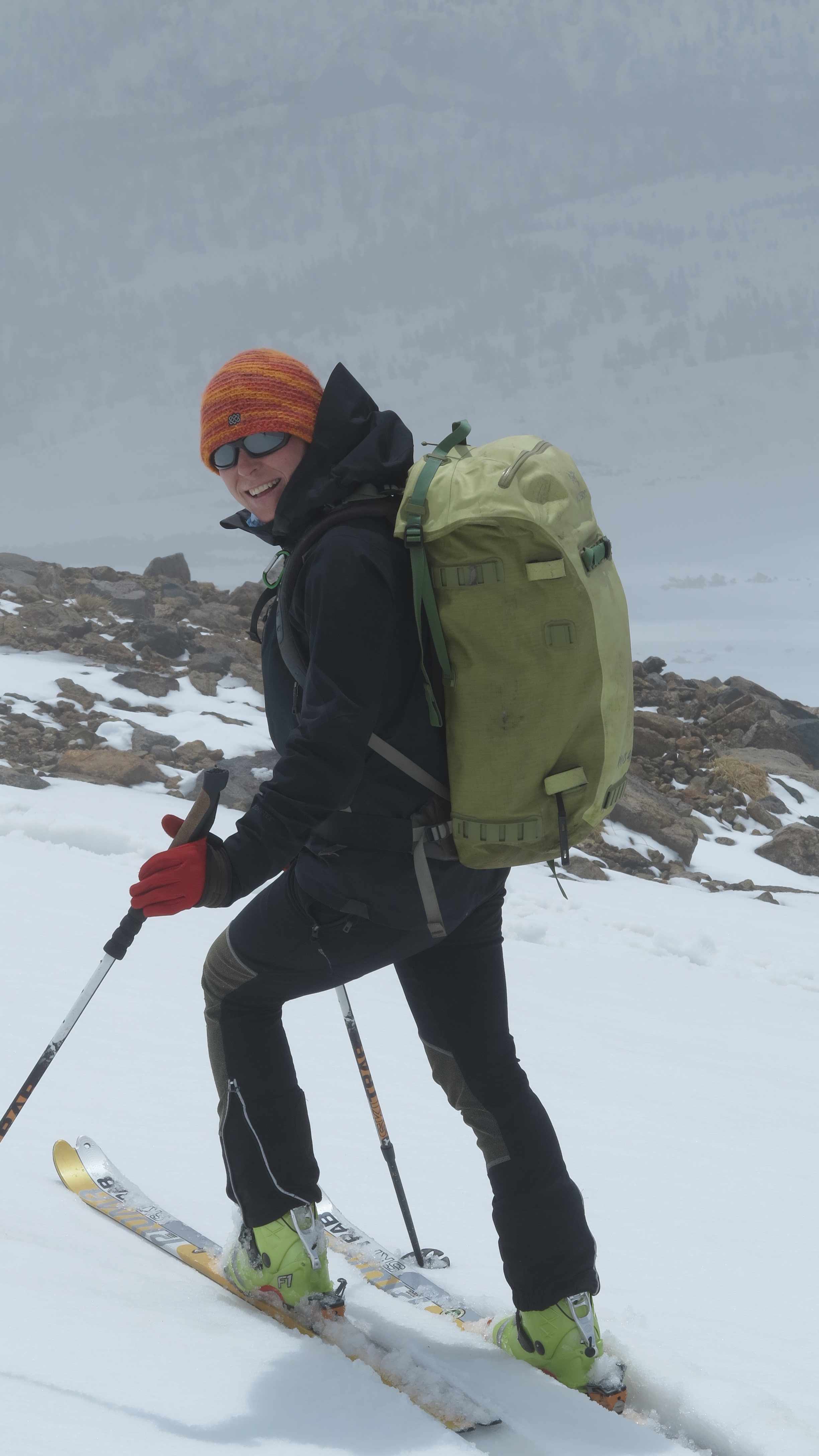
Marco going up with the skis. 
Impeccable down hill position of the wife….and then she disappeared in the fog!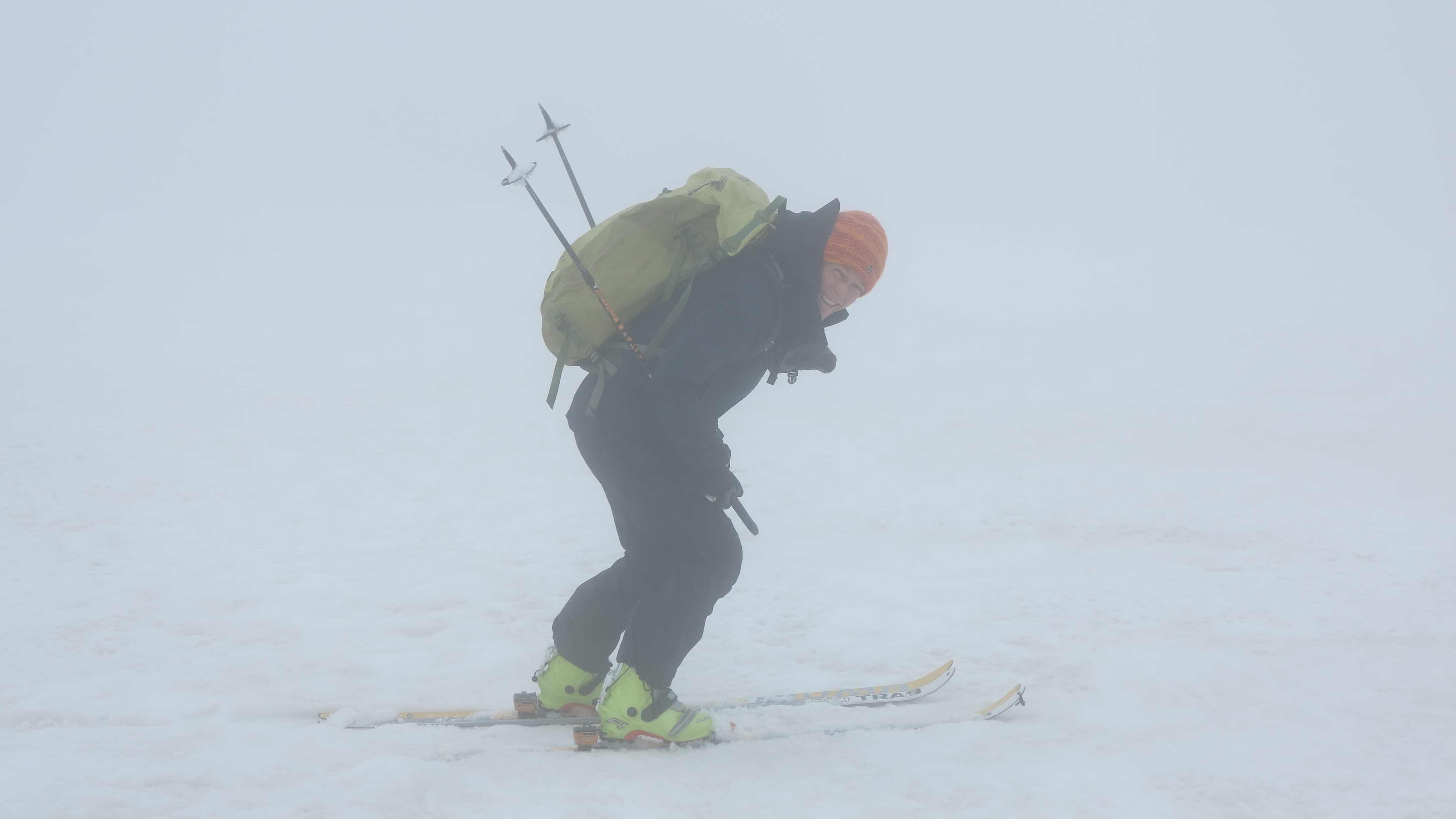
The afterskiing was fantastic – under the rain in the outdoor “rotenburo” wit natural hot spring water. 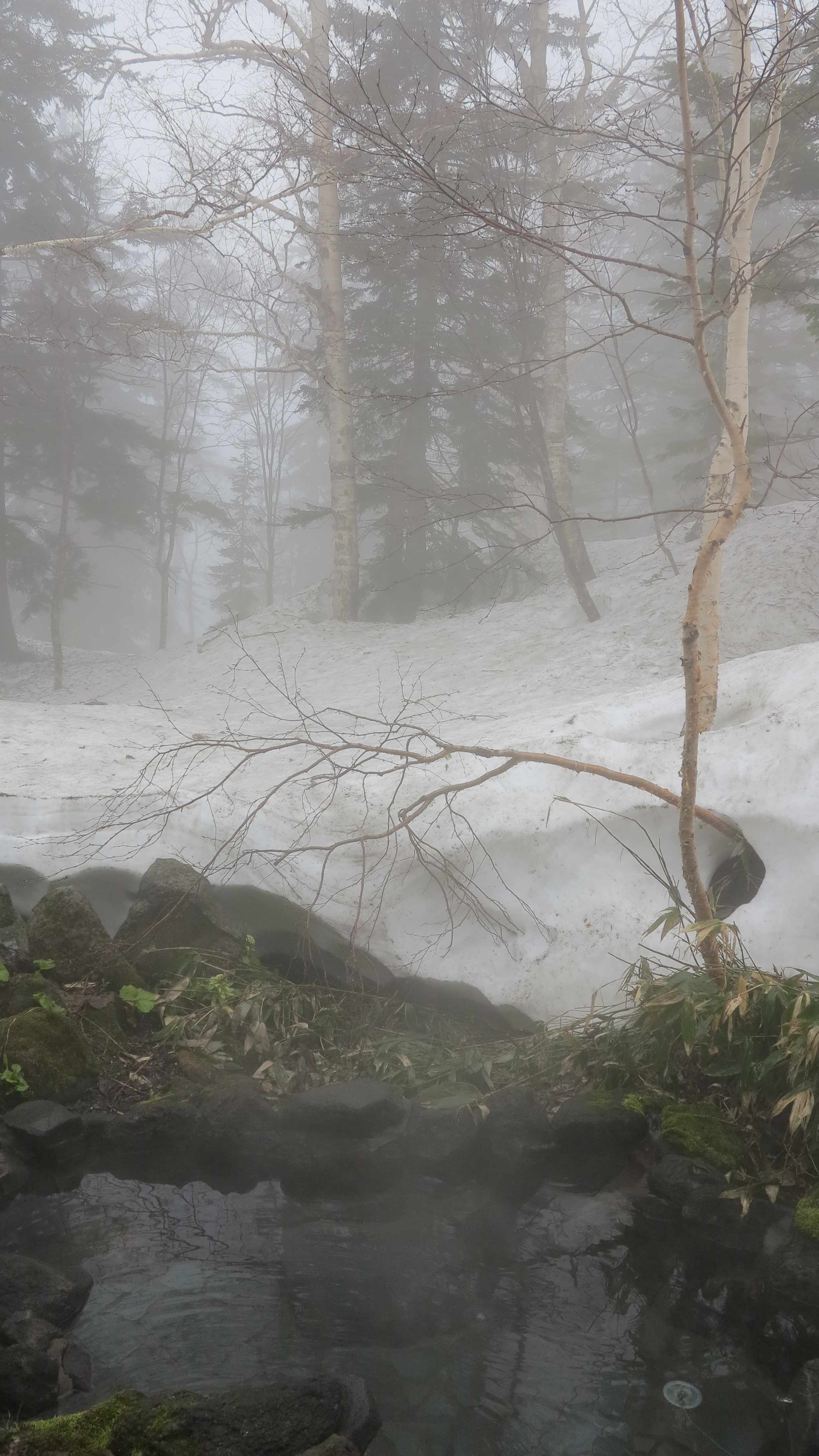
The following day the weather was beautiful and so we went for the summit. We were not the only ones going up.
There was a fresh layer of snow on top from last night and we enjoyed a lot to make our traces across the fresh white surface.
The mountain was fuming and steaming.


As we got closer to the top the landscape changed. The clouds closed in and everything was covered in ice and snow.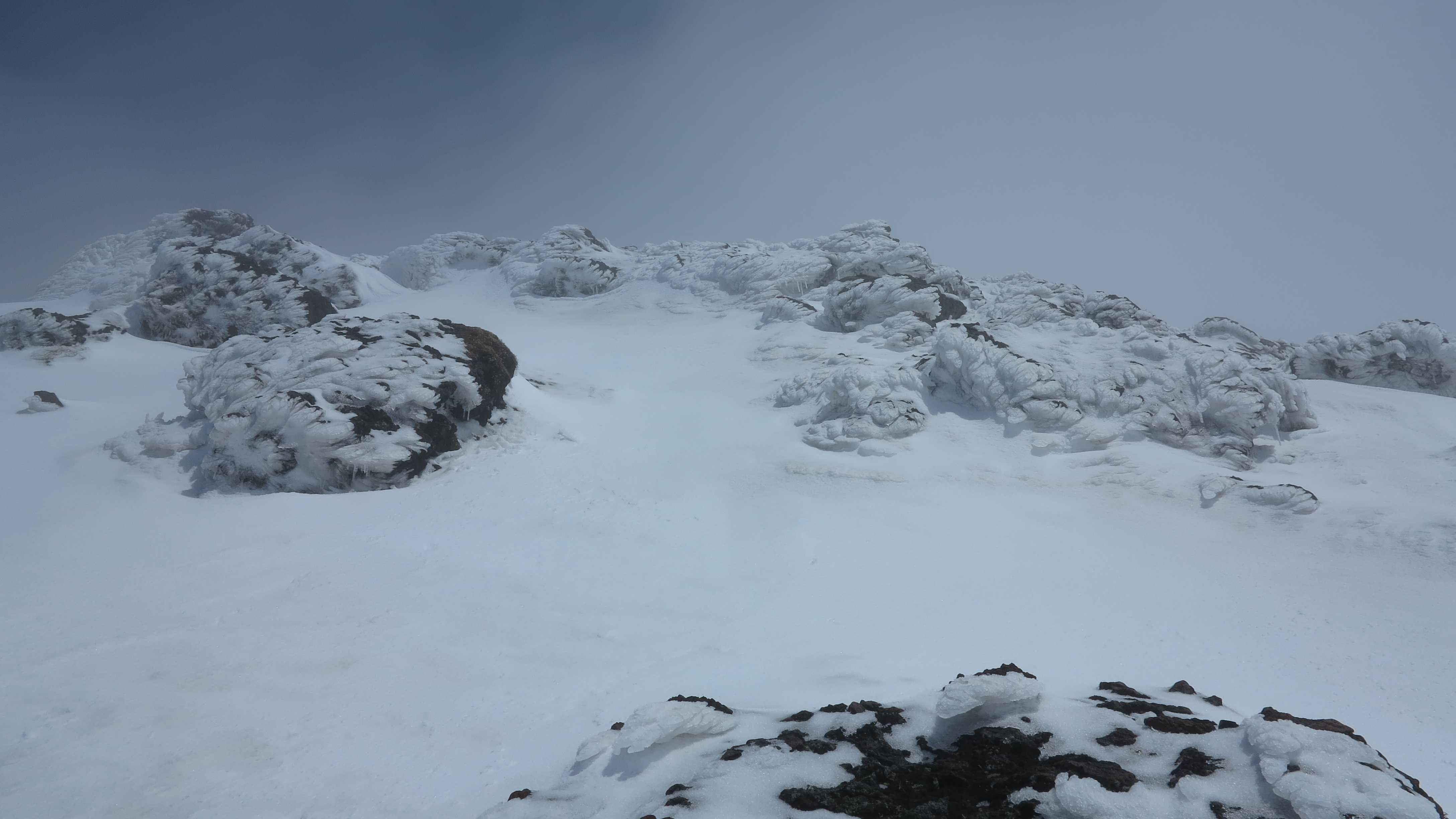
At the summit! Above the clouds with a clear blue sky above.
Arrow pointing to the way down. 
The wife skiing down. Too fast for the camera… 
How did I get down from there??? 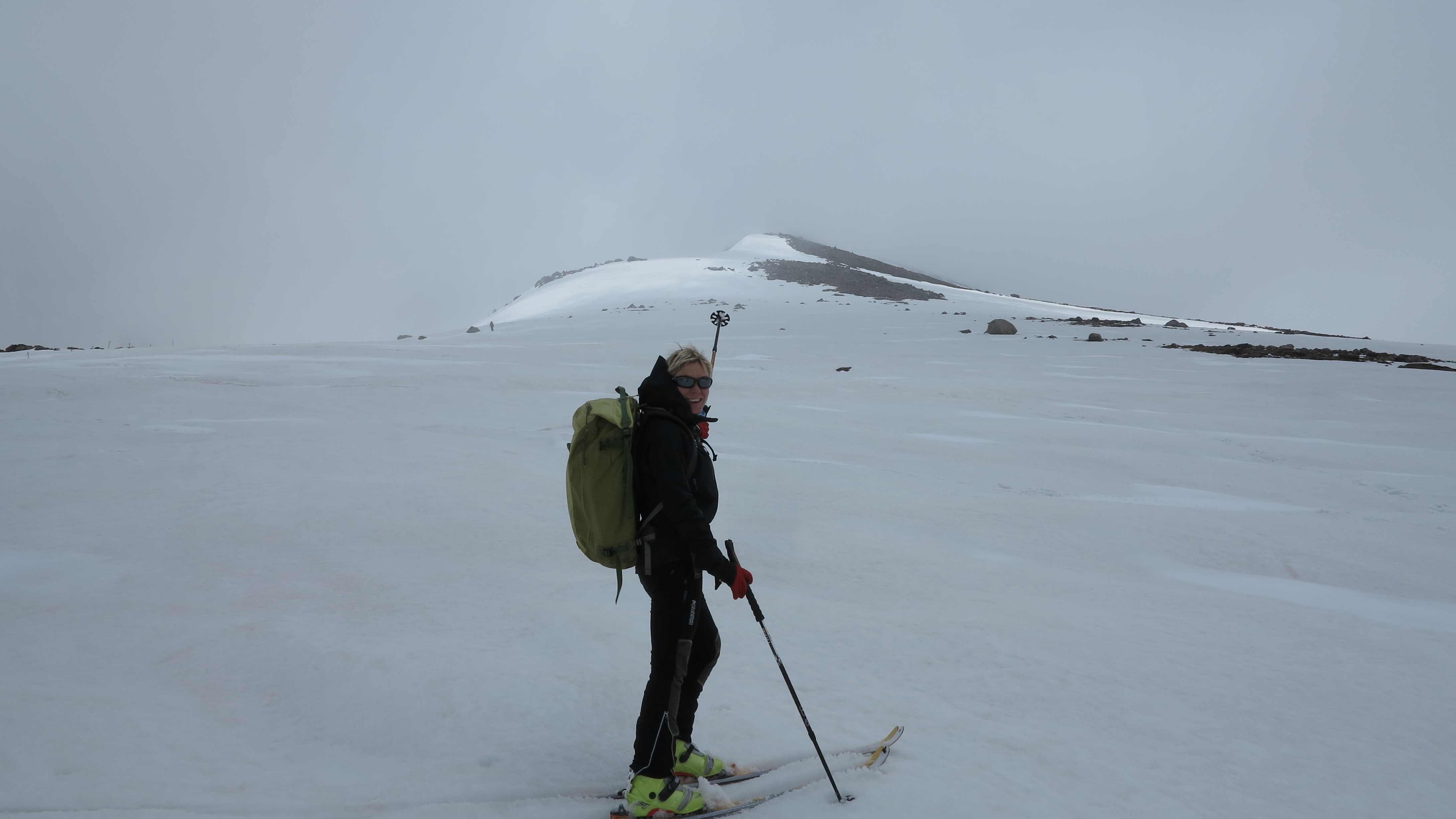
The master supreme of the skis, the wife, Frida and all the universe in general.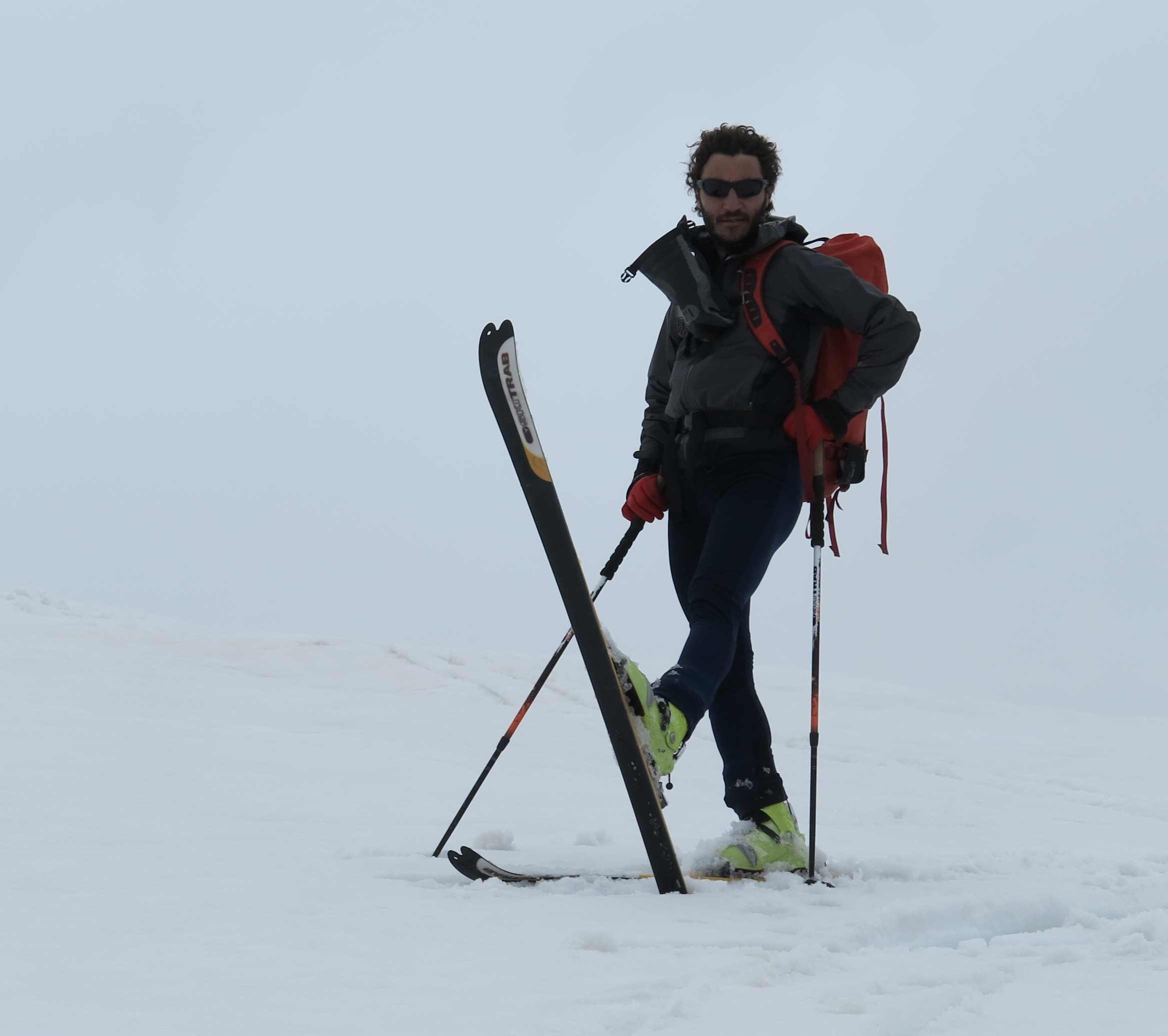
And the wife enjoying the natural hot spring “rotenburo” after the mountain!
_________________________
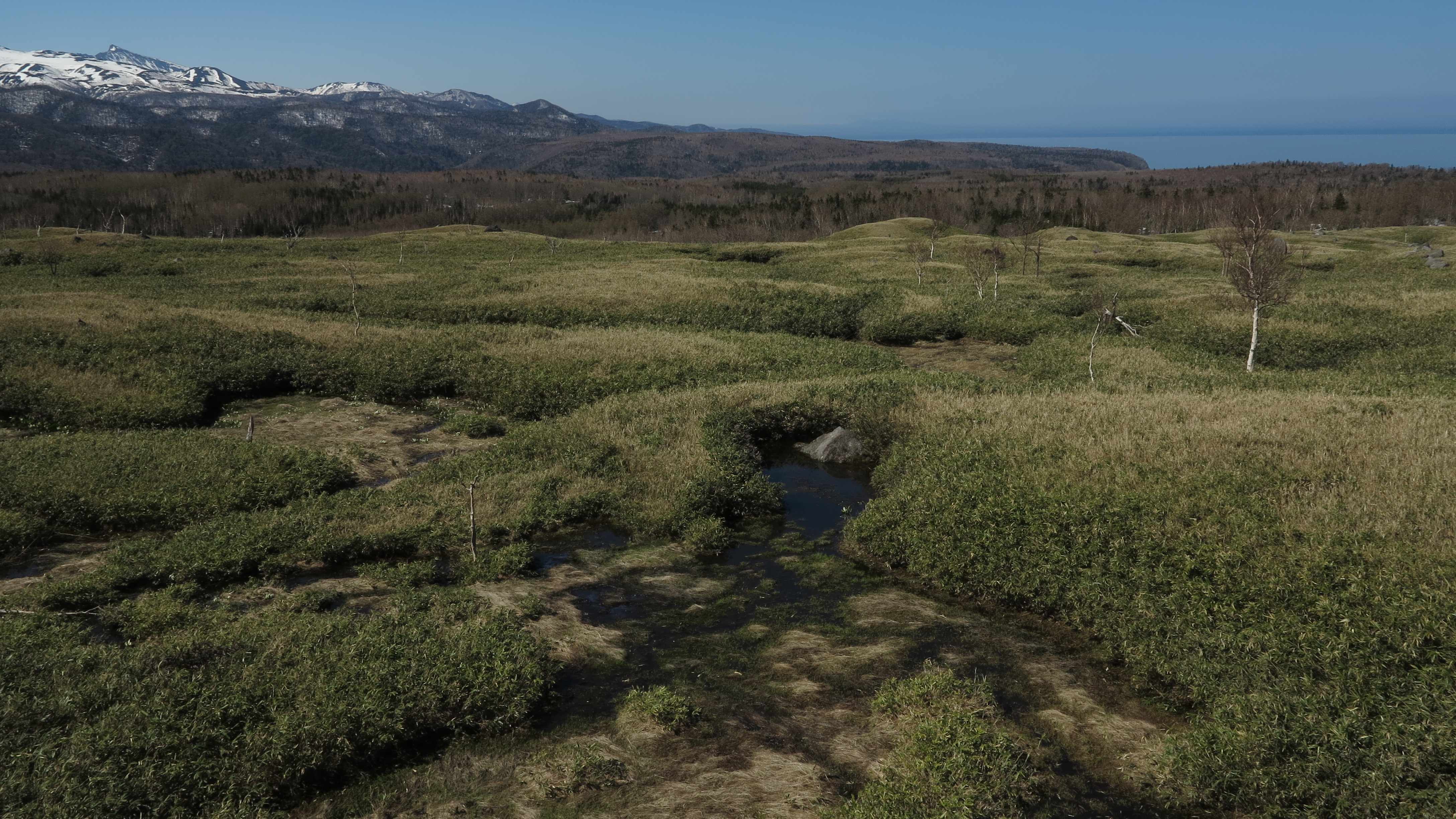
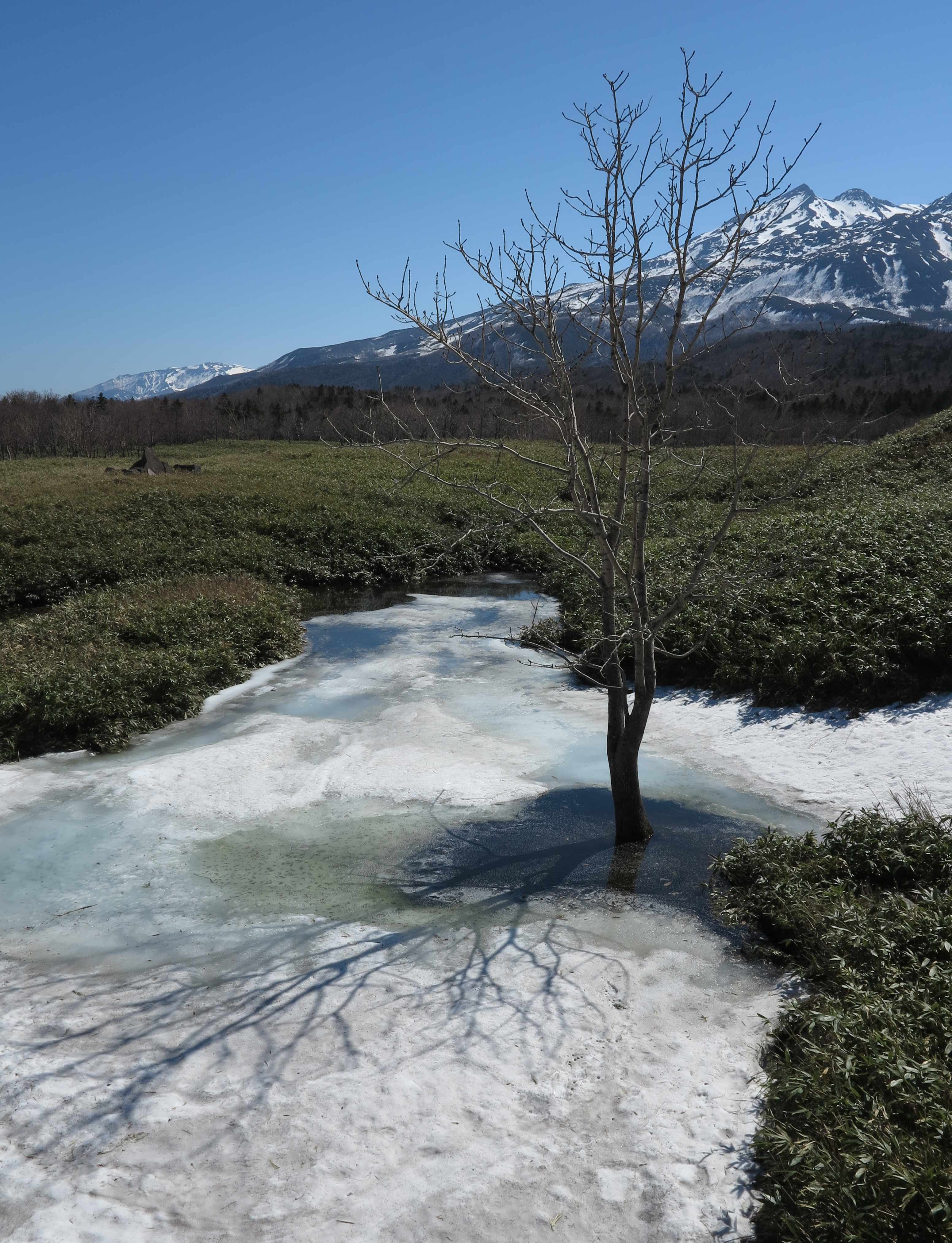
Shiretoko Peninsular
Northeastern Hokkaido, 25-26 May 2013
The Shiretoko is a world heritage National Park, full of beautiful pristine nature and brown bears. Now the mountains in the central part of the peninsular are still full of snow, but we would like to come back and climb them later. To the right, Rausu-dake, the tallest mountain of the peninsular at 1,661 m.

View over the Sea of Okhotsk, direction Sakhalin.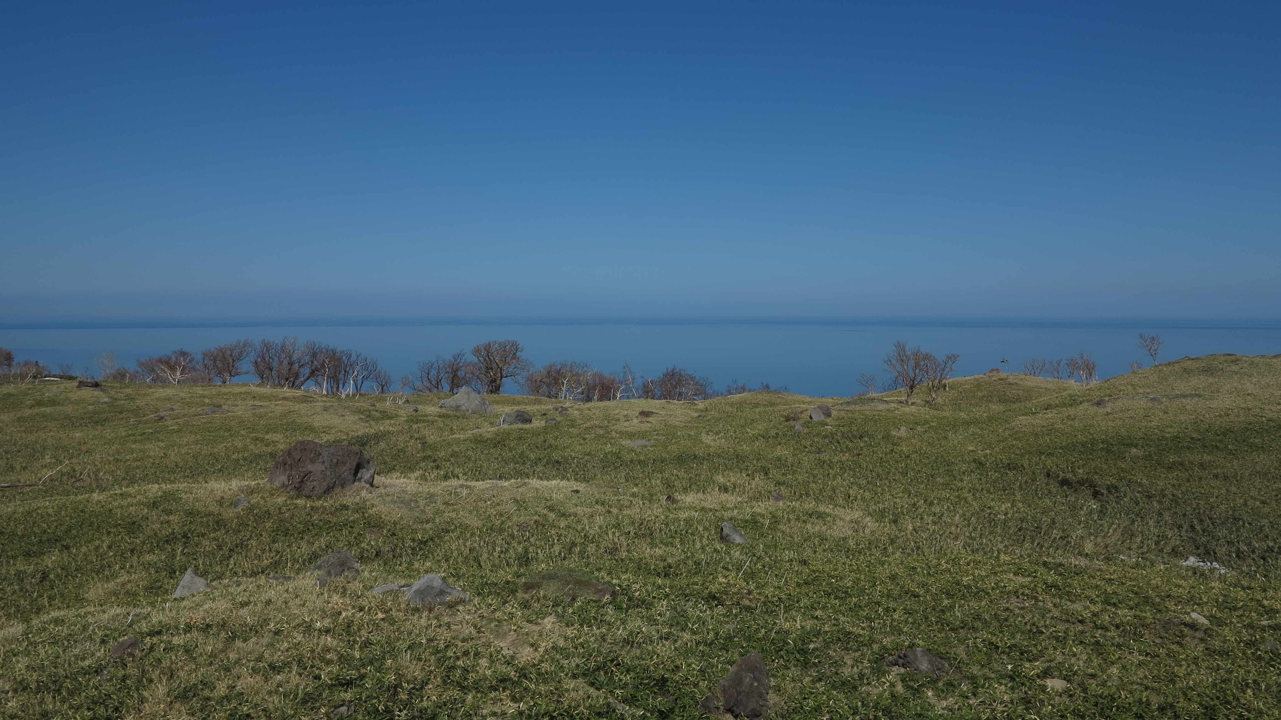
From the eastern side of the Shiretoko Peninsular you can see the Kuril Islands, Russia.
From the northeastern corner of Hokkaido we crossed the island to catch the ferry back to the main Honshu Island. The valleys are dominated by farm land.
Farm land with a beautiful view.
Newly planted rice fields. 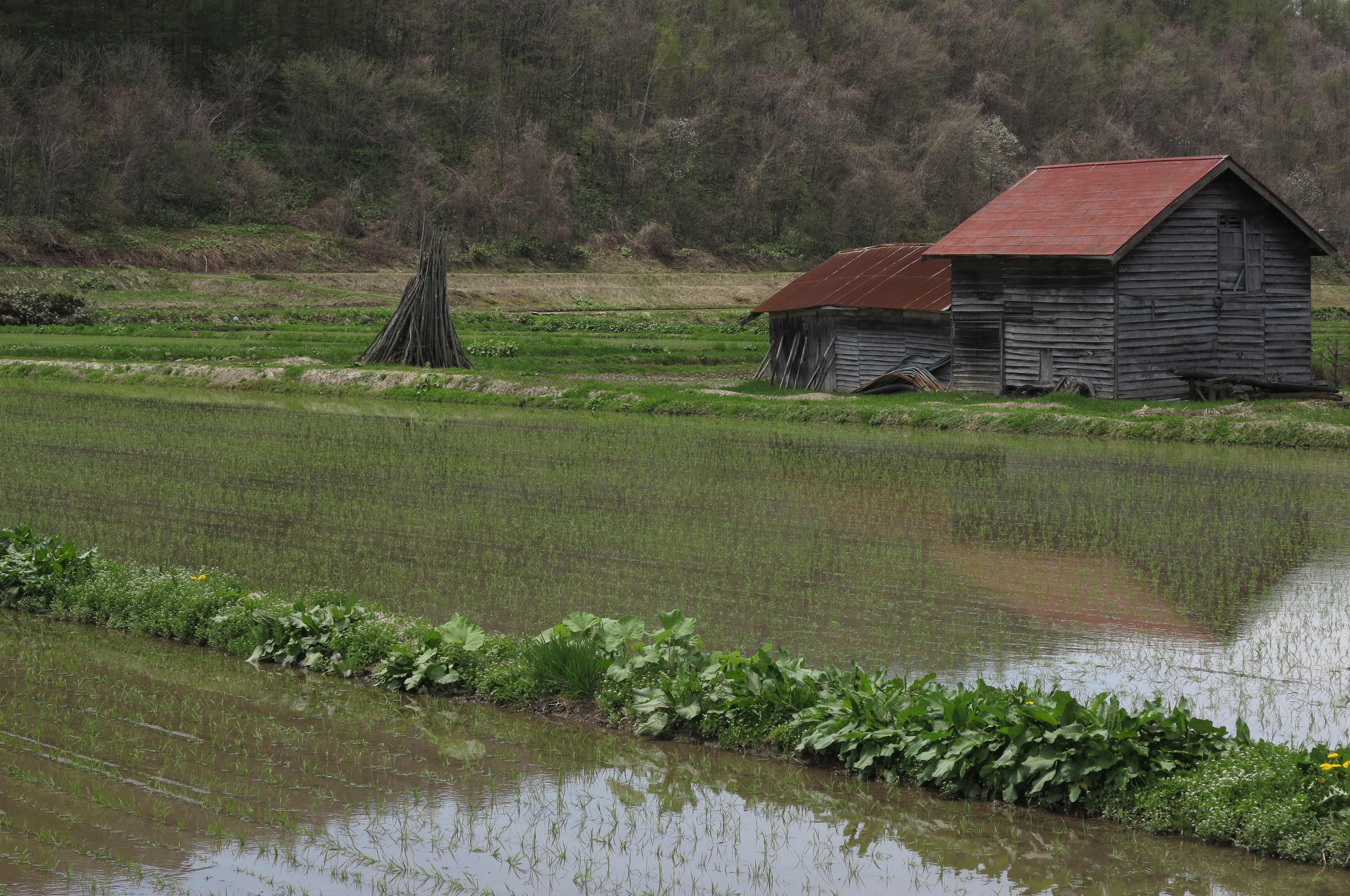
__________________________
From Aomori to Tokyo
Driving south along the “spine” of the Honshu Island, 28-30 May 2013.
We took the slow way back down to Tokyo from Aomori, following the small roads running through the mountains in the center of Japan. And we were amazed at how beautiful the scenery was with dense forests, rivers, water falls, volcanos and lakes.
On 29 May we celebrated our one year anniversary for the trip. We spent the day remembering people, places and foods around the world. Here is a CHEERS to everyone we met along the way!
Anniversary breakfast at the Towadako Lake. 

Fortunately, Nikko was on our route back down to Tokyo. And yes, Nikko was the place where we ate the small crunchy, salty and sweet “agemanjyu”, a fried bean dumpling which is incredibly tasty. It is served fresh and hot in front of this small shop at the train station square in central Nikko. That was back in the middle of April but we remembered the fantastic taste of the agemanjyu and had to return for more! We parked Frida right in front of the shop where they were happy to see us back 🙂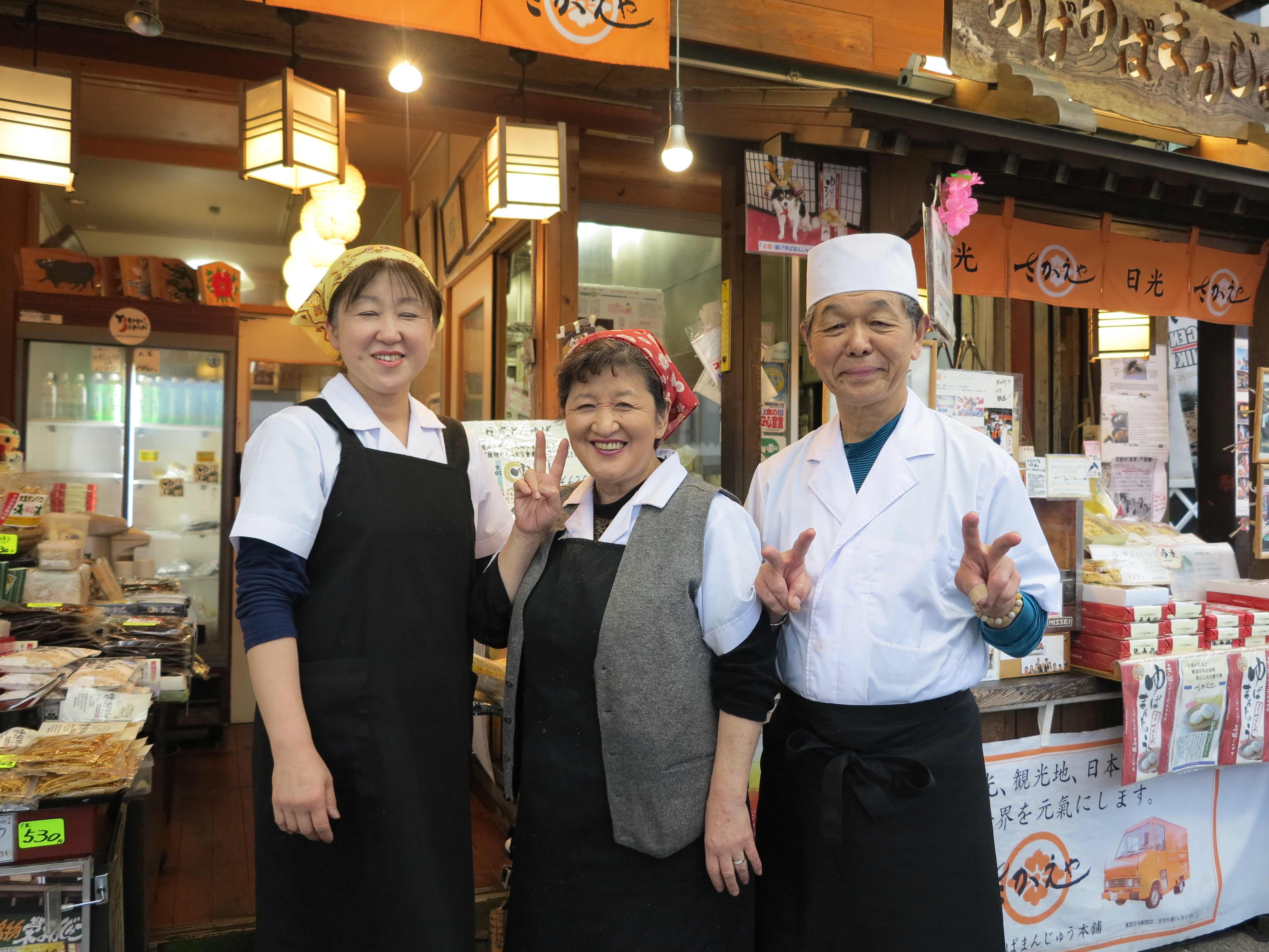
And here are more happy customers eating the agemanjyu!!!
Rice fields in the rain. We are driving through km after km of rice fields, sometimes surrounded on both sides like we are driving through an ocean of rice fields. It is beautiful but somehow it is almost always raining and so it is difficult to capture the beauty in a photo! Here is one rather poor attempt.


June 3rd, 2013 at 3:11 pm
semplicemente fantastico!!!!!!!!! vi penso spesso e, è brutto dirlo, vi invidio…
ciao bravi avanti cosi
June 22nd, 2013 at 11:36 pm
In questo caso l’invidia è accettata!!!! 😀 Continua a seguirci! Ciao
June 6th, 2013 at 10:58 am
ciao ragazzi allora li avete usati ancora gli sci ,bellisime come sempre le foto ci sentiamo