
After the long drive up from Islamabad to Gilgit, we got the car we had managed to rent with the help of friends – and we finally arrived to Hunza!
Hunza was an independent kingdom ruled by the Mirs of Hunza for more than 900 years until the British gained control in 1891. The Karakoram Highway follows the route of the ancient Silk Road – one of its many branches – through the Hunza valley. In the late 19th century, Hunza became involved in the Great Game between Russia and Britain to control the northern access to India. In 1947, Hunza became part of newly formed Pakistan.
The first few days in Hunza the weather was cloudy but we still thought the view from our hotel in Baltit was pretty awesome 🙂
We took a walk through the village and were drawn by the paths going steeply uphill past houses, gardens and fields. Apple trees were everywhere. 
We met our first “Hunza cow” – very pretty and agile small cows, kind of the cow-equivalent to mountains goats…..mountain cows?
We climbed up the very steep hill above the village with a splendid view down through the valley. Just below are the villages of Altit, Baltit and Karimabad at approximately 2400 m altitude. The Hunza River can be seen as a silver thread cutting its way through the valley. It runs in a steep and crumbling gorge below the villages and the Karakoram Highway that continues all the way down to Islamabad to the south and up to the border with China to the northeast. The steep hill side we were scrambling up is just the beginning of the more than 7000 m high mountains that tower over the valley. But these giant mountains were still hidden behind the clouds.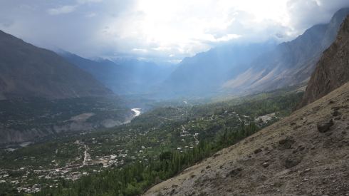
We ended up at the Queen Victoria Monument. The clouds started parting, revealing distant white peaks to the southeast.
The mountains are very steep and severe!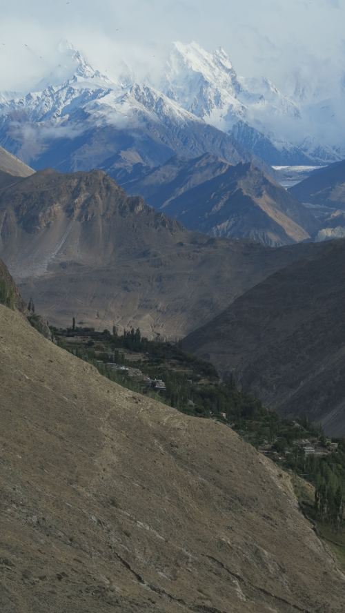
In the valley behind the Queen Victoria monument we could see the black tongue of the Ultar Glacier, coming from the 7388 m high Ultar Sar (still hidden in the clouds). 
It cleared up more and more and the views towards the southeast were fantastic. On the pictures below we are looking down the Nagar Valley and up along the large Barpu Glacier – and in the distance you can see the beautiful “golden” NW face of the 7027 m high Spantik peak.


Looking south across the valley towards the Diran Peak (7266 m). Rakaposhi (7788 m) is behind the clouds to the right.
One more look down the valley to the Hunza River bathed in the rays of the late afternoon sun.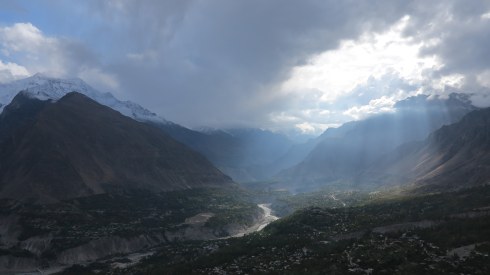
Hunza cow!
Down in the village again, we found a fantastic place to eat which remained our favorite for the next 2 weeks – the Hunza Food Pavilion! 
A couple of days later – still cloudy weather – we tried to go further into the valley and reach the Ultar Glacier but the path is destroyed.

Marco on the well-engineered part of the path.
Hehe 😉

Beautiful colours. 
Hunza apples!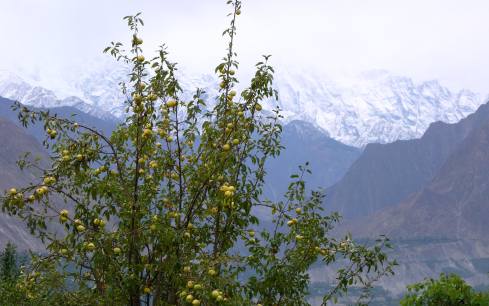
Back to the first page for an overview
Go back to Necropolis of Makli and Shah Jahan Mosque
Go to the drive from Islamabad to Gilgit
Hikes to Rakaposhi Base Camp and Rakaposhi View Point
Day-trip to Khunjerab Pass & Pakistan-Chinese Border
